Back مقاطعة لاك كوي بارلي (مينيسوتا) Arabic Lac qui Parle County, Minnesota BAR Лак ки Паръл (окръг, Минесота) Bulgarian লাক কুই পার্লে কাউন্টি, মিনেসোটা BPY Lac qui Parle Gông (Minnesota) CDO Lac qui Parle County CEB Lac qui Parle County, Minnesota Welsh Lac qui Parle County Danish Lac qui Parle County German Condado de Lac qui Parle Spanish
Lac qui Parle County | |
|---|---|
 | |
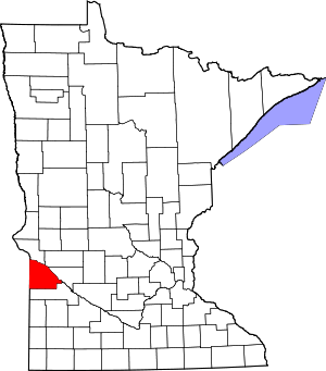
 Location within the U.S. state of Minnesota | |
 Minnesota's location within the U.S. | |
| Coordinates: 45°00′N 96°11′W / 45°N 96.18°W | |
| Country | |
| State | |
| Founded | March 6, 1871[1] |
| Named for | "Lake that speaks" French |
| Seat | Madison |
| Largest city | Dawson |
| Area | |
| • Total | 778 sq mi (2,020 km2) |
| • Land | 765 sq mi (1,980 km2) |
| • Water | 13 sq mi (30 km2) 1.7% |
| Population (2020) | |
| • Total | 6,719 |
| • Estimate (2023) | 6,630 |
| • Density | 8.8/sq mi (3.4/km2) |
| Time zone | UTC−6 (Central) |
| • Summer (DST) | UTC−5 (CDT) |
| Congressional district | 7th |
| Website | lqpco |
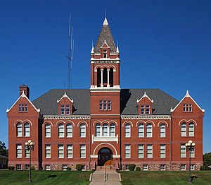
Lac qui Parle County (/ˌlæk ki ˈpɑːrl/ LAK kee PARL)[2] is a county in the southwestern part of the U.S. state of Minnesota. As of the 2020 census, the population was 6,719.[3] Its county seat is Madison.[4] The largest city in the county is Dawson.
- ^ "Minnesota Place Names". Minnesota Historical Society. Archived from the original on June 20, 2012. Retrieved March 18, 2014.
- ^ "Minnesota Pronunciation Guide". Associated Press. Archived from the original on July 22, 2011. Retrieved July 4, 2011.
- ^ "State & County QuickFacts". United States Census Bureau. Retrieved April 19, 2023.
- ^ "Find a County". National Association of Counties. Retrieved June 7, 2011.
© MMXXIII Rich X Search. We shall prevail. All rights reserved. Rich X Search