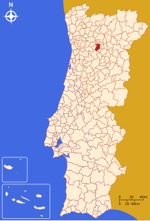
Back لميقة Arabic Lamego Catalan Ламегу CE Lamego (munisipyo) CEB Lamego Kommune Danish Lamego German Lamego Esperanto Lamego Spanish لامگو Persian Lamego Finnish
Lamego | |
|---|---|
 | |
| Coordinates: 41°6′3″N 7°48′36″W / 41.10083°N 7.81000°W | |
| Country | |
| Region | Norte |
| Intermunic. comm. | Douro |
| District | Viseu |
| Parishes | 18 |
| Government | |
| • President | Francisco Lopes (PSD-CDS) |
| Area | |
| • Total | 165.42 km2 (63.87 sq mi) |
| Elevation | 644 m (2,113 ft) |
| Population (2011) | |
| • Total | 26,691 |
| • Density | 160/km2 (420/sq mi) |
| Time zone | UTC±00:00 (WET) |
| • Summer (DST) | UTC+01:00 (WEST) |
| Postal code | 5100 |
| Patron | Santa Maria Maior |
| Website | http://www.cm-lamego.pt |
Lamego (Portuguese pronunciation: [lɐˈmeɣu] ; Proto-Celtic: *Lamecum) is a city and municipality in the Viseu District, in the Norte Region of the Douro in northern Portugal. Located on the shores of the Balsemão River, the municipality has a population of 26,691,[1] in an area of 165.42 km2.[2]
With origins before the Roman occupation of the Iberian Peninsula, Lamego is known for its historic city center, having a long history as a principal city of the former Trás-os-Montes e Alto Douro Province. Legend holds that the first Portuguese Cortes were held in Lamego, in 1143. The Roman Catholic Diocese of Lamego is based in the city center.
- ^ Instituto Nacional de Estatística
- ^ "Áreas das freguesias, concelhos, distritos e país". Archived from the original on 2018-11-05. Retrieved 2018-11-05.
© MMXXIII Rich X Search. We shall prevail. All rights reserved. Rich X Search


