Back Ланден Bulgarian Landen Breton Landen Catalan Landen (parokya) CEB Landen (Belgien) German Landen Esperanto Landen (Bélgica) Spanish Landen Basque لانده Persian Landen French
Landen | |
|---|---|
City and municipality | |
 Parish church St. Gertrude in the city center | |
| Coordinates: 50°45′N 05°05′E / 50.750°N 5.083°E | |
| Country | |
| Community | Flemish Community |
| Region | Flemish Region |
| Province | Flemish Brabant |
| Arrondissement | Leuven |
| Government | |
| • Mayor | Gino Debroux (L'anders) |
| • Governing party/ies | CD&V & L'anders |
| Area | |
| • Total | 53.3 km2 (20.6 sq mi) |
| Population (2018-01-01)[1] | |
| • Total | 15,961 |
| • Density | 300/km2 (780/sq mi) |
| Postal codes | 3400, 3401, 3404 |
| NIS code | 24059 |
| Area codes | 011, 016, 019 |
| Website | www.landen.be |
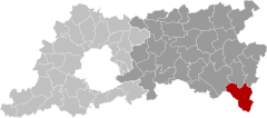
Landen (Dutch pronunciation: [ˈlɑndə(n)] ) is a city and municipality located in the Belgian province of Flemish Brabant. The municipality comprises the city of Landen proper and the villages of Attenhoven, Eliksem, Ezemaal, Laar, Neerlanden, Neerwinden, Overwinden, Rumsdorp, Waasmont, Walsbets, Walshoutem, Wange and Wezeren. On January 1, 2006, Landen had a total population of 14,682. The total area is 54.05 km² which gives a population density of 272 inhabitants per km².
- ^ "Wettelijke Bevolking per gemeente op 1 januari 2018". Statbel. Retrieved 9 March 2019.
© MMXXIII Rich X Search. We shall prevail. All rights reserved. Rich X Search


