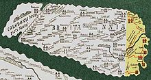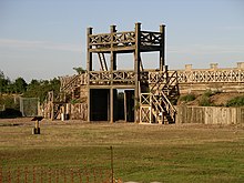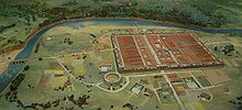


The frontier of the Roman Empire in Britain is sometimes styled Limes Britannicus ("British Limes")[1] by authors[2] for the boundaries, including fortifications and defensive ramparts, that were built to protect Roman Britain (the term Limes is mainly and originally used for the Roman frontier in the Germanic provinces).[3] These defences existed from the 1st to the 5th centuries AD and ran through the territory of present-day England, Scotland and Wales.
Britain was one of the most troubled regions in the European part of the Roman Empire and could only be secured by the Roman Army at considerable effort. Despite a rapid victory over the tribes in the south, which Claudius' field commander, Aulus Plautius, achieved in 43 AD for Rome, the resistance of the British was not completely broken for a long time afterwards. Nevertheless, the Romans succeeded in further consolidating their rule in the period that followed, although the troops stationed there were overburdened by having to defend Britain simultaneously on three fronts. The incursions of barbarians from the north of the island repeatedly caused serious problems. To the west and south, the Britannic provinces had to be defended against Hibernian and Germanic attacks. Against all odds, Britain was held for almost three centuries by the Roman Empire. In retrospect, the Roman domination of Britain is generally considered to be positive.[by whom?] For a long time there was peace and prosperity on the island. Behind the protection of Hadrian's Wall and that formed by the natural coastal boundaries to the east, south and west, the region we now know as England was heavily influenced by the achievements of Roman civilisation. Hadrian's Wall and the castra on the Saxon Shore are still the most prominent symbols of Roman rule over Britain.[4]
- ^ Haverfield, Francis John (1911). . In Chisholm, Hugh (ed.). Encyclopædia Britannica. Vol. 16 (11th ed.). Cambridge University Press. pp. 695–696, see page 695.
...Thus the Wall of Hadrian in north England (see Britain: Roman) is now sometimes styled the Limes Britannicus...
- ^ Great Walls and Linear Barriers, Peter Spring, Pen and Sword, 2015, Chap. 24. ISBN 1473853842, 9781473853843
- ^ Benjamin Isaac, "The Meaning of 'Limes' and 'Limitanei' in Ancient Sources", Journal of Roman Studies, 78 (1988), pp. 125–147
- ^ Doel/Lloyd 2000, p. 19
© MMXXIII Rich X Search. We shall prevail. All rights reserved. Rich X Search
