Back قائمة مدن وبلدات وقرى ميشيغان Arabic میشیقان ایالتین شهرلری AZB Munisipalitas ring Michigan BAN Liste der Städte, Dörfer und Townships in Michigan German Anexo:Localidades de Míchigan Spanish Liste des municipalités du Michigan French Daftar kota di Michigan ID Città del Michigan Italian മിഷിഗണിലെ ഗ്രാമങ്ങളുടേയും ചെറു പട്ടണങ്ങളുടേയും പട്ടിക Malayalam Liste over byer i Michigan NB


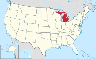
Michigan is a state in the Midwest region of the United States. According to the 2020 United States Census, Michigan is the 10th most populous state with 10,077,331 inhabitants and the 22nd largest by land area spanning 56,538.90 square miles (146,435.1 km2) of land.[1] Michigan is divided into 83 counties and contains 1,773 municipalities consisting of 276 cities, 257 villages, and 1,240 townships.[2] The largest municipality by population in Michigan is Detroit with 639,111 residents;[1] the smallest municipality by population is Pointe Aux Barques Township with 15 residents.[3] The largest municipality by land area is McMillan Township which spans 588.78 sq mi (1,524.9 km2), while Ahmeek is the smallest at 0.07 sq mi (0.18 km2).[4]
Municipalities include incorporated cities and villages, and townships (often referred to collectively as "CVTs"[5][6][7]), which may either be general law or chartered. Charter townships are unique to Michigan among U.S. states, are delegated more power over local taxation, but have more municipal responsibilities and obligations.[8][9] Cities are not subject to a township's jurisdiction, but villages remain part of the township in which they are located; village residents pay both township and village taxes, and share services with the township. Since all Michigan residents who do not live in a city live in a township, a village's population is counted in the population of the township in which it is located.[10]
- ^ a b "QuickFacts". 2020 United States Census. United States Census Bureau. Retrieved September 14, 2021.
- ^ "Michigan: 2010 Population and Housing Unit Counts 2010 Census of Population and Housing" (PDF). 2010 United States Census. United States Census Bureau. September 2012. p. III-2. Archived (PDF) from the original on October 19, 2012. Retrieved August 8, 2016.
- ^ "P1. Race: 2020 DEC Redistricting Data (PL 94-171) – All county subdivisions within Michigan". U.S. Census bureau. Archived from the original on July 10, 2023. Retrieved July 10, 2023.
- ^ "GCT-PH1 – Population, Housing Units, Area, and Density: 2010 – State — Place and (in selected states) County Subdivision". 2010 United States Census. United States Census Bureau. Archived from the original on February 13, 2020. Retrieved August 8, 2016.
- ^ "Revenue Sharing Overview" (PDF). Michigan Senate Fiscal Agency. January 2023.
- ^ "Townships in Michigan". Michigan Townships Association. Retrieved October 15, 2024.
- ^ "OC Municipal District". Oakland County, Michigan. Retrieved October 15, 2024.
- ^ Prykucki, Bethany (November 19, 2014). "Understanding townships in Michigan". Michigan State University Extension. Michigan State University. Archived from the original on July 29, 2022. Retrieved March 27, 2022.
- ^ Michigan Legislature. "The Charter Township Act: Act 359 of 1947" (PDF). State of Michigan. Archived (PDF) from the original on March 24, 2022. Retrieved March 28, 2022.
- ^ "Municipal Report: Organization of City and Village Government in Michigan" (PDF). Handbook for Charter Commissioners: Resource Materials for Village Charter Revision. Michigan Municipal League. Archived from the original (PDF) on August 16, 2021. Retrieved August 16, 2021.
© MMXXIII Rich X Search. We shall prevail. All rights reserved. Rich X Search