Logan Square | |
|---|---|
| Community Area 22 – Logan Square | |
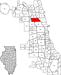
 Location within the city of Chicago | |
| Coordinates: 41°55.7′N 87°42.4′W / 41.9283°N 87.7067°W | |
| Country | United States |
| State | Illinois |
| County | Cook |
| City | Chicago |
| Neighborhoods | |
| Area | |
| • Total | 3.23 sq mi (8.37 km2) |
| Population (2020)[1] | |
| • Total | 71,665 |
| • Density | 22,000/sq mi (8,600/km2) |
| Demographics (2020)[1] | |
| • White | 51.6% |
| • Black | 4.5% |
| • Hispanic | 36.3% |
| • Asian | 4.2% |
| • Other | 3.3% |
| Time zone | UTC−6 (CST) |
| • Summer (DST) | UTC−5 (CDT) |
| ZIP Codes | parts of 60614, 60618, 60622, 60639, 60647 |
| Median household income (2020) | $84,653[1] |
| Source: Chicago Metropolitan Agency for Planning (CMAP) July 2022 Release | |
Logan Square is an official community area, historical neighborhood, and public square on the northwest side of the City of Chicago. The Logan Square community area is one of the 77 city-designated community areas established for planning purposes. The Logan Square neighborhood, located within the Logan Square community area, is centered on the public square that serves as its namesake, located at the three-way intersection of Milwaukee Avenue, Logan Boulevard and Kedzie Boulevard.
The community area of Logan Square is, in general, bounded by the Metra/Milwaukee District North Line railroad on the west, the North Branch of the Chicago River on the east, Diversey Parkway on the north, and the 606 (also known as the Bloomingdale Trail) on the south.[2] The area is characterized by the prominent historical boulevards, stately greystones and large bungalow-style homes.
- ^ a b c "Community Data Snapshot - Logan Square" (PDF). cmap.illinois.gov. MetroPulse. Retrieved September 1, 2022.
- ^ Logan Square chicago.gov
© MMXXIII Rich X Search. We shall prevail. All rights reserved. Rich X Search
