Back خليج نيويورك السفلي Arabic Lower New York Bay Catalan Lower Bay (luuk sa Tinipong Bansa, New Jersey) CEB Lower New York Bay German Lower New York Bay Estonian Lower New York Bay French מפרץ ניו יורק התחתון HE Lower New York Bay Italian ロウアー・ニューヨーク湾 Japanese Lower New York Bay Portuguese


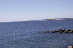
Lower New York Bay is a section of New York Bay south of the Narrows (the strait between Staten Island and Brooklyn). The eastern end of the Bay is marked by two spits of land, Sandy Hook, New Jersey, and Rockaway, Queens. The waterway between the spits connects the Bay to the Atlantic Ocean at the New York Bight. Traversing the floor of the Bay southeasterly from the Narrows to the Bight and beyond is Hudson Canyon.
Roughly the northeastern portion of the Bay from the Narrows to Sandy Hook is known as the Lower Bay (named in relation to the neighboring Upper [New York] Bay); roughly the western portion of the Bay (including the portion at the mouth of New Jersey's Raritan River) is called Raritan Bay; and roughly the southeastern portion of the Bay (that is, the portion south and the portion southwest from Sandy Hook) is known as Sandy Hook Bay.
© MMXXIII Rich X Search. We shall prevail. All rights reserved. Rich X Search