Back Lynden Pindling International Airport CEB Flughafen Nassau Lynden Pindling German Aeropuerto Internacional Lynden Pindling Spanish فرودگاه بینالمللی لیندن پیندلینگ Persian Lynden Pindlingin kansainvälinen lentoasema Finnish Aéroport international Lynden Pindling French Bandar Udara Internasional Lynden Pindling ID Aeroporto Internazionale Lynden Pindling Italian リンデン・ピンドリング国際空港 Japanese 린든 핀들링 국제공항 Korean
Lynden Pindling International Airport | |||||||||||||||
|---|---|---|---|---|---|---|---|---|---|---|---|---|---|---|---|
 | |||||||||||||||
 | |||||||||||||||
| Summary | |||||||||||||||
| Airport type | Public | ||||||||||||||
| Owner | Nassau Airport Development Company (Government of The Bahamas) | ||||||||||||||
| Operator | Vantage Airport Group | ||||||||||||||
| Serves | Nassau, Bahamas | ||||||||||||||
| Hub for | |||||||||||||||
| Elevation AMSL | 16 ft / 5 m | ||||||||||||||
| Coordinates | 25°02′20″N 077°27′58″W / 25.03889°N 77.46611°W | ||||||||||||||
| Website | nassaulpia | ||||||||||||||
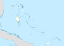
| Map | |||||||||||||||
| Runways | |||||||||||||||
| |||||||||||||||
| Statistics (2019) | |||||||||||||||
| |||||||||||||||
Lynden Pindling International Airport (IATA: NAS, ICAO: MYNN), formerly known as Nassau International Airport, is the largest airport in the Bahamas and the largest international gateway into the country. It is a hub for Bahamasair, Western Air, and Pineapple Air. The airport is located in western New Providence island near the capital city of Nassau. The airport is named after Lynden Pindling, the first prime minister of the Bahamas.
- ^ "Airport information for MYNN". World Aero Data. Archived from the original on 5 March 2019.
{{cite web}}: CS1 maint: unfit URL (link) Data current as of October 2006. Source: DAFIF. - ^ Airport information for NAS at Great Circle Mapper. Source: DAFIF (effective October 2006).
© MMXXIII Rich X Search. We shall prevail. All rights reserved. Rich X Search
