Back M8 motorway German آزادراه ام۸ (اسکاتلند) Persian Autoroute M8 (Grande-Bretagne) French M8 mòr-rathad Scots/Gaelic Motorway M8 Italian Autostrada M8 (Scozzia) LMO M8 (Groot-Brittannië) Dutch Autostrada M8 (Wielka Brytania) Polish M8 motorway (Scotland) SCO M8 motorway (Scotland) SIMPLE
| M8 | ||||
|---|---|---|---|---|
M8 highlighted in blue | ||||
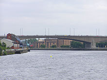
 Looking north from Charing Cross | ||||
| Route information | ||||
| Part of | ||||
| Maintained by Transport Scotland | ||||
| Length | 60.3 mi (97.0 km) | |||
| Existed | 1965–present | |||
| History | Opened: 1965 Completed: 2017 | |||
| Major junctions | ||||
| East end | Sighthill 55°55′28″N 3°18′46″W / 55.9244°N 3.3128°W | |||
J2 → M9 motorway J8 → M73 motorway/A8(M) motorway J13 → M80 motorway J21 → M74 motorway J22 → M77 motorway J30 → M898 motorway | ||||
| West end | Langbank 55°55′24″N 4°33′01″W / 55.9234°N 4.5504°W | |||
| Location | ||||
| Country | United Kingdom | |||
| Constituent country | Scotland | |||
| Counties | Edinburgh, West Lothian, North Lanarkshire, Glasgow, Renfrewshire | |||
| Primary destinations | Edinburgh Edinburgh Airport Livingston Glasgow Paisley Glasgow Airport Greenock | |||
| Road network | ||||
| ||||


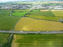
The M8 is the busiest motorway in Scotland.[1] It connects the country's two largest cities, Glasgow and Edinburgh, and serves other large communities including Airdrie, Coatbridge, Greenock, Livingston and Paisley. The motorway is 60 miles (97 km) long. A major construction project to build the final section between Newhouse and Baillieston was completed on 30 April 2017. The motorway has one service station, Heart of Scotland Services, previously named Harthill due to its proximity to the village.
- ^ "Road traffic estimates in Great Britain: 2021 tables". Department for Transport. Retrieved 13 February 2023.
© MMXXIII Rich X Search. We shall prevail. All rights reserved. Rich X Search

