Back مابتون Arabic مابتون ARZ مبتون، واشینقتون AZB Мабтън Bulgarian Mabton Catalan Мабтон (Вашингтон) CE Mabton CEB Mabton, Washington Welsh Mabton (Washington) Spanish Mabton (Washington) Basque
Mabton | |
|---|---|
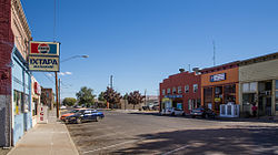
 Main Street | |
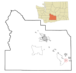
 Location of Mabton, Washington | |
| Coordinates: 46°12′42″N 119°59′47″W / 46.21167°N 119.99639°W | |
| Country | United States |
| State | Washington |
| County | Yakima |
| Incorporated | November 7, 1905 |
| Government | |
| • Type | Mayor–council[1] |
| • Mayor | Rachel Ruelas[2] |
| Area | |
| • Total | 0.82 sq mi (2.13 km2) |
| • Land | 0.82 sq mi (2.13 km2) |
| • Water | 0.00 sq mi (0.00 km2) |
| Elevation | 715 ft (218 m) |
| Population | |
| • Total | 1,959 |
| • Estimate (2021)[5] | 1,948 |
| • Density | 2,752.43/sq mi (1,062.70/km2) |
| Time zone | UTC-8 (PST) |
| • Summer (DST) | UTC-7 (PDT) |
| ZIP code | 98935 |
| Area code | 509 |
| FIPS code | 53-40980 |
| GNIS feature ID | 1512417[6] |
| Website | cityofmabton.com |
Mabton is a city in Yakima County, Washington, United States. The population was 1,959 at the 2020 census.[4] Incorporated during the first few years of the 20th century, it is located at the eastern edge of the Yakama Indian Reservation.
- ^ "Mabton, Washington - Code of Ordinances Title 1 - GENERAL PROVISIONS". municode.com. Retrieved April 10, 2022.
- ^ "City Government". City of Mabton. Retrieved April 10, 2022.
- ^ "2019 U.S. Gazetteer Files". United States Census Bureau. Retrieved August 7, 2020.
- ^ a b "Explore Census Data". United States Census Bureau. Retrieved September 13, 2022.
- ^ Cite error: The named reference
USCensusEst2021was invoked but never defined (see the help page). - ^ "US Board on Geographic Names". United States Geological Survey. October 25, 2007. Retrieved January 31, 2008.
© MMXXIII Rich X Search. We shall prevail. All rights reserved. Rich X Search