Back مقاطعة ماديسون (أركنساس) Arabic Madison County, Arkansas BAR Медисън (окръг, Арканзас) Bulgarian মেডিসন কাউন্টি, আরকান্সাস BPY Madison Gông (Arkansas) CDO Мэдисон (гуо, Арканзас) CE Madison County (kondado sa Tinipong Bansa, Arkansas) CEB Madison County, Arkansas Welsh Madison County (Arkansas) German Κομητεία Μάντισον (Άρκανσο) Greek
Madison County | |
|---|---|
|
Clockwise from top: A rural scene in Madison County near Forum, Madison County Courthouse in Huntsville, War Eagle Creek Bridge, Kings River Falls and swimming hole at the Kings River Falls Natural Area | |
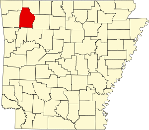
 Location within the U.S. state of Arkansas | |
 Arkansas's location within the U.S. | |
| Coordinates: 36°01′38″N 93°41′45″W / 36.027222222222°N 93.695833333333°W | |
| Country | |
| State | |
| Founded | September 30, 1836 |
| Named for | Madison County, Alabama |
| Seat | Huntsville |
| Largest city | Huntsville |
| Area | |
| • Total | 837 sq mi (2,170 km2) |
| • Land | 834 sq mi (2,160 km2) |
| • Water | 2.8 sq mi (7 km2) 0.3% |
| Population (2020) | |
| • Total | 16,521 |
| • Density | 20/sq mi (7.6/km2) |
| Time zone | UTC−6 (Central) |
| • Summer (DST) | UTC−5 (CDT) |
| Congressional district | 3rd |
| Website | madisoncogov |
Madison County is a county located in the U.S. state of Arkansas. As of the 2020 census, the population was 16,521.[1] The county seat is Huntsville.[2] The county was formed on September 30, 1836, and named for Madison County, Alabama, the home of some early settlers. They also named the county seat after Madison County in Alabama's county seat, Huntsville.[3]
Madison County is part of the Northwest Arkansas region.
- ^ "Census - Geography Profile: Madison County, Arkansas". United States Census Bureau. Retrieved January 20, 2023.
- ^ "Find a County". National Association of Counties. Retrieved June 7, 2011.
- ^ Haden, Rebecca (February 5, 2019). "Madison County". Encyclopedia of Arkansas. Central Arkansas Library System. Retrieved November 6, 2021.
© MMXXIII Rich X Search. We shall prevail. All rights reserved. Rich X Search


