Back مقاطعة ماغوفين (كنتاكي) Arabic Magoffin County, Kentucky BAR Магофин (окръг, Кентъки) Bulgarian মাগোফিন কাউন্টি, কেন্টাকি BPY Magoffin Gông (Kentucky) CDO Мэгоффин (гуо, Кентукки) CE Magoffin County CEB Magoffin County, Kentucky Welsh Magoffin County German Condado de Magoffin Spanish
Magoffin County | |
|---|---|
 Magoffin County justice center in Salyersville | |
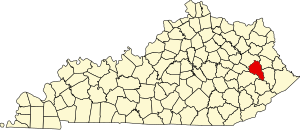
 Location within the U.S. state of Kentucky | |
 Kentucky's location within the U.S. | |
| Coordinates: 37°42′N 83°04′W / 37.7°N 83.06°W | |
| Country | |
| State | |
| Founded | 1860 |
| Named for | Beriah Magoffin |
| Seat | Salyersville |
| Largest city | Salyersville |
| Area | |
| • Total | 309 sq mi (800 km2) |
| • Land | 308 sq mi (800 km2) |
| • Water | 0.7 sq mi (2 km2) 0.2% |
| Population (2020) | |
| • Total | 11,637 |
| • Estimate (2023) | 11,228 |
| • Density | 38/sq mi (15/km2) |
| Time zone | UTC−5 (Eastern) |
| • Summer (DST) | UTC−4 (EDT) |
| Congressional district | 5th |
| Website | magoffincounty |
Magoffin County is a county located in the U.S. state of Kentucky. As of the 2020 census, the population was 11,637.[1] Its county seat is Salyersville.[2] The county was formed in 1860 from adjacent portions of Floyd, Johnson, and Morgan Counties. It was named for Beriah Magoffin who was Governor of Kentucky (1859–62).[3][4]
- ^ "Census - Geography Profile: Magoffin County, Kentucky". United States Census Bureau. Retrieved December 30, 2022.
- ^ "Find a County". National Association of Counties. Retrieved June 7, 2011.
- ^ E., Kleber, John; Kentucky, University Press of; Policy, Institute for Regional Analysis and Public; Library, Camden-Carroll; University, Morehead State (January 1, 2000). "The Kentucky Encyclopedia".
{{cite web}}:|last3=has generic name (help)CS1 maint: multiple names: authors list (link) - ^ The Register of the Kentucky State Historical Society, Vol. 1. Kentucky State Historical Society. 1903. p. 36.
© MMXXIII Rich X Search. We shall prevail. All rights reserved. Rich X Search