Back Маі-Ндамбэ (правінцыя) Byelorussian Маі-Ндамбэ BE-X-OLD Ме Ндомбе Bulgarian Mai-Ndombe (Provinz) German Mai-Ndombe Provinco Esperanto Provincia de Mai-Ndombe Spanish استان مای-ندومبی Persian Mai-Ndombe Finnish Mai-Ndombe (province) French Mai-Ndombe (Prowins) FRR
Mai-Ndombe
Province du Mai-Ndombe (French) | |
|---|---|
 | |
 | |
| Coordinates: 01°57′S 18°16′E / 1.950°S 18.267°E | |
| Country | |
| Established | 2015 |
| Named for | Lake Maï Ndombe |
| Capital | Inongo |
| Government | |
| • Governor | Rita Bola Dula[1][2] |
| Area | |
| • Total | 127,465 km2 (49,215 sq mi) |
| Population (2020 est.) | |
| • Total | 2,254,100 |
| • Density | 18/km2 (46/sq mi) |
| Time zone | UTC+1 (WAT) |
| License Plate Code | |
| Official language | French |
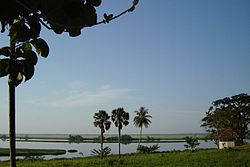
Mai-Ndombe is one of the 21 new provinces of the Democratic Republic of the Congo created in the 2015 repartitioning. Mai-Ndombe, Kwango, and Kwilu provinces are the result of the dismemberment of the former Bandundu province.[3] Mai-Ndombe was formed from the Plateaux and Mai-Ndombe districts. The town of Inongo was elevated to capital city of the new province.
The 2020 population was estimated to be 2,254,100.[4]
- ^ Matanga, Patrick (18 August 2022). "Maï-Ndombe : Rita Bola officiellement aux commandes de la province". Yabisonews (in French). Retrieved 19 August 2022.
- ^ "Après son investiture, Rita Bola veut consolider la paix au Mai-Ndombe". Radio Okapi (in French). 1 August 2022. Retrieved 19 August 2022.
- ^ "RDC: démembrement effectif du Bandundu". Radio Okapi (in French). 19 July 2015. Archived from the original on 20 July 2015. Retrieved 4 June 2020.
- ^ "Congo (Dem. Rep.): Provinces, Major Cities & Towns - Population Statistics, Maps, Charts, Weather and Web Information". www.citypopulation.de. Retrieved 2024-02-11.
© MMXXIII Rich X Search. We shall prevail. All rights reserved. Rich X Search
