Back Makhonjwaberge Afrikaans Barberton Makhonjwa AVK Maxonyvua dağları Azerbaijani Barberton Makhonjwa French הרי ברברטון מקונג'ווה HE Barberton Makhonjwa Croatian Montagne di Barberton Makhonjwa Italian マコンジュワ山脈 Japanese Barberton-Makhonjwa-Berge LLD Muntanji Makhonjwa ta' Barberton Maltese
| Makhonjwa Mountains | |
|---|---|
| Barberton greenstone belt | |
 Barberton Makhonjwa Mountains on 10 March 2021; seen from space with the Operational Land Imager with Landsat 8. The Komati River runs across the centre. Eerstehoek and Elukwatini is in the lower left, with the Makhonjwa Mountains up top. | |
| Highest point | |
| Elevation | 1,800 m (5,900 ft) |
| Geography | |
| Countries | South Africa and Eswatini |
| Range coordinates | 25°47′06″S 31°03′07″E / 25.785°S 31.052°E[1] |
| Official name | Barberton Makhonjwa Mountains |
| Type | Natural |
| Criteria | (viii) |
| Designated | 2018 |
| Reference no. | 1575 |
| Region | Africa |
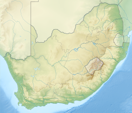
The Makhonjwa Mountains or Barberton Makhonjwa Mountains are a range of small mountains and hills that covers an area of 120 by 60 kilometres (75 by 37 mi), about 80% in Mpumalanga, a province of South Africa, and the remainder in neighbouring Eswatini.[2] It constitutes 40% of the Barberton Greenstone Belt.[3]
- ^ "Barberton, Mpumalanga". Latitude.
- ^ "The Barberton Mountain Land, Barberton Greenstone Belt or Makhonjwa Mountains". UNESCO. Retrieved 10 December 2014.
- ^ "Barberton Makhonjwa Mountains". UNESCO.
© MMXXIII Rich X Search. We shall prevail. All rights reserved. Rich X Search
