Back مانسفيلد ايه بونتفراكت (كيبك) Arabic Mansfield-et-Pontefract CEB Mansfield-et-Pontefract (Quebec) Basque منسفیلد-ا-پونتفراکت، کبک Persian Mansfield-et-Pontefract French Mansfield-et-Pontefract, Quebec HAK Mansfield-et-Pontefract Italian Mansfield-et-Pontefract Swedish
Mansfield-et-Pontefract | |
|---|---|
 | |
 Location within Pontiac RCM | |
| Coordinates: 45°51′40″N 76°44′21″W / 45.86111°N 76.73917°W[1] | |
| Country | Canada |
| Province | Quebec |
| Region | Outaouais |
| RCM | Pontiac |
| Constituted | January 1, 1868 |
| Government | |
| • Mayor | Sandra Armstrong |
| • Federal riding | Pontiac |
| • Prov. riding | Pontiac |
| Area | |
| • Total | 523.45 km2 (202.11 sq mi) |
| • Land | 466.61 km2 (180.16 sq mi) |
| Population (2021)[3] | |
| • Total | 2,250 |
| • Density | 4.8/km2 (12/sq mi) |
| • Pop (2016-21) | |
| • Dwellings | 1,074 |
| Time zone | UTC−5 (EST) |
| • Summer (DST) | UTC−4 (EDT) |
| Postal code(s) | |
| Area code | 819 |
| Highways | |
| Website | www |


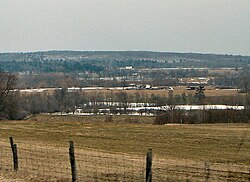
Mansfield-et-Pontefract is a municipality in the Pontiac Regional County Municipality of western Quebec, Canada. It is located on the Ottawa River, northwest of Gatineau. It is the most populated municipality in the Pontiac Regional County Municipality, with most of the population and businesses concentrated along Quebec Route 148.[4]
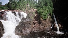
It is home to the main tourist attractions of the Pontiac region: the Chutes Coulonge, the George Bryson House, and the Félix-Gabriel-Marchand Bridge.
- ^ Cite error: The named reference
toponymiewas invoked but never defined (see the help page). - ^ a b "Mansfield-et-Pontefract". Ministère des Affaires municipales et de l'Habitation (in French). Retrieved 26 October 2022.
- ^ a b "Mansfield-et-Pontefract, Municipalité (MÉ) Census Profile, 2021 Census of Population". www12.statcan.gc.ca. Government of Canada - Statistics Canada. Retrieved 26 October 2022.
- ^ Lisa Corrigan. "Municipality". Municipality of Mansfield-et-Pontefract. Retrieved 2011-04-12.
© MMXXIII Rich X Search. We shall prevail. All rights reserved. Rich X Search
