Back جبل ماسانوتين ARZ Massanutten Mountain CEB Massanutten Mountain German Massanutten Finnish Massanutten Mountain LLD
| Massanutten Mountain | |
|---|---|
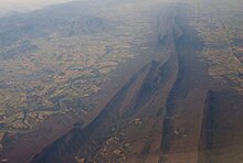
 View of Massanutten Mountain from the east, looking west from Hawksbill Peak, with Luray in the foreground and the Great North Mountain in the background. August 2007. | |
| Highest point | |
| Elevation | 2,922 ft (891 m) |
| Coordinates | 38°38′34.9″N 78°36′43.3″W / 38.643028°N 78.612028°W |
| Geography | |
Virginia, U.S. | |
| Parent range | Ridge-and-Valley Appalachians |
| Geology | |
| Mountain type | Synclinal Ridge |
| Climbing | |
| Easiest route | Drive |

Massanutten Mountain is a synclinal ridge in the Ridge-and-Valley Appalachians, located in the U.S. state of Virginia.

© MMXXIII Rich X Search. We shall prevail. All rights reserved. Rich X Search
