Back McKean Township, Pennsylvania Welsh Municipio de McKean (Pensilvania) Spanish McKean Township (Pennsylvanie) French Маккін Тауншип (округ Ері, Пенсільванія) Ukrainian Xã McKean, Quận Erie, Pennsylvania Vietnamese
McKean Township | |
|---|---|
 Junction of Interstates 79 and 90 in McKean Township | |
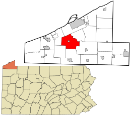
 Location in Erie County and the state of Pennsylvania. | |
 Location of Pennsylvania in the United States | |
| Coordinates: 41°58′0″N 80°4′59″W / 41.96667°N 80.08306°W | |
| Country | United States |
| State | Pennsylvania |
| County | Erie |
| Settled | 1795 |
| Incorporated | March 12, 1800 |
| Area | |
| • Total | 36.95 sq mi (95.71 km2) |
| • Land | 36.80 sq mi (95.31 km2) |
| • Water | 0.15 sq mi (0.40 km2) |
| Highest elevation [2] (southeast corner of township) | 1,570 ft (480 m) |
| Lowest elevation [2] (Elk Creek) | 850 ft (260 m) |
| Population | |
| • Total | 4,437 |
| • Estimate (2023)[3] | 4,370 |
| • Density | 118.97/sq mi (45.93/km2) |
| Time zone | UTC-4 (EST) |
| • Summer (DST) | UTC-5 (EDT) |
| Area code | 814 |
| FIPS code | 42-049-46224 |
| Website | www |
McKean Township is a township in Erie County, Pennsylvania, United States. The population was 4,437 at the 2020 census,[3] up from 4,409 at the 2010 census,[4] down from 4,619 in 2000.
- ^ "2016 U.S. Gazetteer Files". United States Census Bureau. Retrieved August 13, 2017.
- ^ a b "McKean P O and Station Topo Map, Erie County PA (Edinboro North Area)". TopoZone. Locality, LLC. Retrieved September 4, 2019.
- ^ a b c Bureau, US Census. "City and Town Population Totals: 2020-2023". Census.gov. US Census Bureau. Retrieved July 1, 2024.
- ^ "Geographic Identifiers: 2010 Demographic Profile Data (G001): McKean township, Erie County, Pennsylvania". American Factfinder. U.S. Census Bureau. Archived from the original on February 13, 2020. Retrieved March 21, 2016.
© MMXXIII Rich X Search. We shall prevail. All rights reserved. Rich X Search