Back মিরপুর Bengali/Bangla মিরপুর থানা BPY मीरपुर मॉडल थाना Hindi मीरपूर Marathi Mirpur Thana SIMPLE மிர்பூர் தாணா Tamil میرپورماڈل تھانہ Urdu
Mirpur Thana
মিরপুর থানা | |
|---|---|
 Mirpur 10 Night view | |
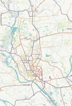
 Expandable map of vicinity of Mirpur Model Thana | |
| Coordinates: 23°48′17″N 90°21′47″E / 23.80464°N 90.36305°E | |
| Country | |
| Division | Dhaka Division |
| District | Dhaka District |
| Established as a thana | 1962 |
| Area | |
| • Total | 4.71 km2 (1.82 sq mi) |
| Elevation | 23 m (75 ft) |
| Population (2011)[2] | |
| • Total | 500,373 |
| • Density | 106,236/km2 (275,150/sq mi) |
| Time zone | UTC+6 (BST) |
| Area code | 1216[3] |
Mirpur (Bengali: মিরপুর) is a thana of Dhaka city, Bangladesh. It is bounded by Pallabi Thana to the north, Mohammadpur Thana to the south, Kafrul to the east, and Savar Upazila to the west.[4][5] For administrative convenience three new thanas, namely Shah Ali, Pallabi Thana and Kafrul Thana have been carved out of old Mirpur Thana.[6]
- ^ "Geographic coordinates of Dhaka, Bangladesh". DATEANDTIME.INFO. Retrieved 7 July 2016.
- ^ Bangladesh Bureau of Statistics (2011). "Population & Housing Census" (PDF). Bangladesh Government. Archived from the original (PDF) on 3 September 2017. Retrieved 17 April 2015.
- ^ "ঢাকা পোস্টকোড". ডাক অধিদপ্তর. Retrieved 2024-01-17.
- ^ Farooque, Md. Abu Hasan (2012). "Mirpur Model Thana". In Islam, Sirajul; Jamal, Ahmed A. (eds.). Banglapedia: National Encyclopedia of Bangladesh (Second ed.). Asiatic Society of Bangladesh.
- ^ "Where is Mirpur, Dhaka, Bangladesh on Map Lat Long Coordinates". www.latlong.net. Retrieved 2023-04-15.
- ^ "Table S04: Summary Statistics by Thana and Zila". Population and Housing Census, 1991. Archived from the original on March 27, 2005. Retrieved November 10, 2006.
© MMXXIII Rich X Search. We shall prevail. All rights reserved. Rich X Search


