| Misquamicut State Beach | |
|---|---|
 The pavilion at Misquamicut State Beach | |
| Location | Westerly, Rhode Island |
| Coordinates | 41°19′23″N 71°48′17″W / 41.3230°N 71.8046°W[1] |
| Area | 51.35 acres (20.78 ha)[2] |
| Elevation | 7 ft (2.1 m)[1] |
| Established | 1959 |
| Administrator | Rhode Island Department of Environmental Management, Division of Parks & Recreation |
| Website | Misquamicut State Beach |
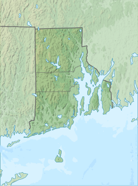
Misquamicut State Beach (MISS-kwahm-eh-kut[3]) is a seaside public recreation area in the town of Westerly, Rhode Island.[4] It occupies a portion of Misquamicut Beach, a 3-mile-long (4.8 km) barrier island that extends westward from Weekapaug to Watch Hill and separates Winnapaug Pond from the Atlantic Ocean.[5] The state beach covers 51 acres (21 ha) and features a large beach pavilion with multiple public facilities.[4]
- ^ a b "Misquamicut State Beach". Geographic Names Information System. United States Geological Survey, United States Department of the Interior.
- ^ Cite error: The named reference
parksarchivewas invoked but never defined (see the help page). - ^ Farzan, Antonia Noori. "Rhode Island pronunciation guide: 35 names that visitors and even some locals get wrong". The Providence Journal. Retrieved July 4, 2024.
- ^ a b Cite error: The named reference
parkswas invoked but never defined (see the help page). - ^ Cite error: The named reference
historywas invoked but never defined (see the help page).
© MMXXIII Rich X Search. We shall prevail. All rights reserved. Rich X Search

