Back Canal de la Mona Catalan Mona Passage (agianan) CEB Mona (průliv) Czech Mona-Passage German Mona Markolo Esperanto Canal de la Mona Spanish Mona väil Estonian Mona itsasartea Basque Canal de la Mona French Prolaz Mona Croatian
| Mona Passage | |
|---|---|
| Canal de la Mona | |
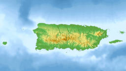
 Location of the Mona Passage. | |
| Coordinates | 18°30′N 67°53′W / 18.500°N 67.883°W |
| Basin countries | Puerto Rico (United States) Dominican Republic |
The Mona Passage (Spanish: Canal de la Mona) is a strait that separates the islands of Hispaniola and Puerto Rico. The Mona Passage connects the Atlantic Ocean to the Caribbean Sea and is an important shipping route between the Atlantic and the Panama Canal.
The Mona Passage is 80 miles (130 kilometers) long. It is fraught with variable tidal currents created by large islands on either side of it, and by sand banks that extend out from both coasts.
© MMXXIII Rich X Search. We shall prevail. All rights reserved. Rich X Search
