Back مقاطعة مونتاغ (تكساس) Arabic Montague County, Texas BAR Мантэйг (акруга) Byelorussian Монтейг (окръг, Тексас) Bulgarian মন্টাগ কাউন্টি, টেক্সাস BPY Montague Gông (Texas) CDO Montague County CEB Montague County Czech Montague County, Texas Welsh Montague County German
Montague County | |
|---|---|
County | |
 The Montague County Courthouse in Montague | |
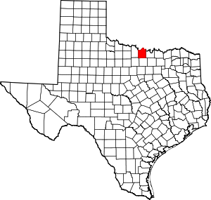
 Location within the U.S. state of Texas | |
 Texas's location within the U.S. | |
| Coordinates: 33°40′N 97°44′W / 33.67°N 97.73°W | |
| Country | |
| State | |
| Founded | 1858 |
| Named for | Daniel Montague |
| Seat | Montague |
| Largest city | Bowie |
| Area | |
| • Total | 938 sq mi (2,430 km2) |
| • Land | 931 sq mi (2,410 km2) |
| • Water | 7.4 sq mi (19 km2) 0.8% |
| Population (2020) | |
| • Total | 19,965 |
| • Density | 21/sq mi (8.2/km2) |
| Time zone | UTC−6 (Central) |
| • Summer (DST) | UTC−5 (CDT) |
| Congressional district | 13th |
| Website | www |
Montague County (/ˈmɒnteɪɡ/ MAHN-tayg)[1][2] is a county located in the U.S. state of Texas, established in 1857. As of the 2020 census, its population was 19,965.[3] The county seat is Montague.[4] The county was created in 1857 and organized the next year.[5] It is named for Daniel Montague, a surveyor and soldier in the Mexican–American War.
- ^ "How to Pronounce: M Cities". September 23, 2014. Retrieved May 20, 2018.
- ^ "Texas Almanac Town Pronunciation Guide" (PDF). Archived (PDF) from the original on October 9, 2022.
- ^ "Montague County, Texas". United States Census Bureau. Retrieved February 23, 2021.
- ^ "Find a County". National Association of Counties. Retrieved June 7, 2011.
- ^ "Texas: Individual County Chronologies". Texas Atlas of Historical County Boundaries. The Newberry Library. 2008. Retrieved May 25, 2015.
© MMXXIII Rich X Search. We shall prevail. All rights reserved. Rich X Search