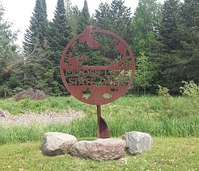
| Moose Lake State Park | |
|---|---|
 Entrance sign | |
| Location | Carlton, Minnesota, United States |
| Coordinates | 46°26′30″N 92°44′11″W / 46.44167°N 92.73639°W |
| Area | 1,194 acres (4.83 km2) |
| Established | 1971 |
| Governing body | Minnesota Department of Natural Resources |
Moose Lake State Park is a state park of Minnesota, USA, near the city of Moose Lake, MN in Carlton County. The park is located one-half mile east of Interstate 35 at the 214 exit. The park entrance is off of County Highway 137. Moose Lake State Park was established in 1971. In total, the park is 1,194 acres in area. Some of the highlights of the park include 5.5 miles of hiking trails, a 105-acre Echo Lake, wildlife pond, paved trail to Moose Lake and Willard Munger State Trail, and Agate/Geological Interpretive Center; located within the park office.
© MMXXIII Rich X Search. We shall prevail. All rights reserved. Rich X Search


