Back Мцхеҭа-Мҭианеҭи Abkhazian متسخيتا-متيانيتي Arabic Msxeta-Mtianeti Azerbaijani Мцхета-Мтианети Bashkir Мцхета-Мтыянеты Byelorussian Мцхэта-Мтыянэці BE-X-OLD Мцхети-Мтианети Bulgarian Mtsc'hetha-Mthianethi Breton Mtskheta-Mtianeti Catalan Мцхета-Мтианети CE
Mtskheta-Mtianeti
მცხეთა-მთიანეთი | |
|---|---|
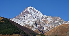
From the top to bottom-right: Kazbegi National Park, Gergeti Trinity Church, Lake Tina in Juta Valley, Pshav-Khevsureti National Park, Mtskheta | |
![Overlapping borders of de jure Mtskheta-Mtianeti region and de facto South Ossetia[nt 1]](http://upload.wikimedia.org/wikipedia/commons/thumb/1/1d/Mtskheta-Mtianeti_in_Georgia_%28disputed_hatched%29.svg/250px-Mtskheta-Mtianeti_in_Georgia_%28disputed_hatched%29.svg.png) Overlapping borders of de jure Mtskheta-Mtianeti region and de facto South Ossetia[nt 1] | |
| Country | |
| Seat | Mtskheta |
| Subdivisions | 5 Municipalities[1] |
| Government | |
| • Governor | Davit Nozadze[2] |
| Area | |
| • Total | 5,606 km2 (2,164 sq mi) |
| Population (2021)[4] | |
| • Total | 93,389 |
| • Density | 17/km2 (43/sq mi) |
| Gross Regional Product | |
| • Total | ₾ 1.63 billion (2022) |
| • Per Capita | ₾ 17,720 (2022) |
| ISO 3166 code | GE-MM |
| HDI (2021) | 0.745[6] high · 10th |
| Website | www |
Mtskheta-Mtianeti (Georgian: მცხეთა-მთიანეთი, literally "Mtskheta-Mountain Area") is a region (Mkhare) in eastern Georgia comprising the town of Mtskheta, which serves as a regional capital, together with its district and the adjoining mountainous areas. The western part of the region, namely the entire Akhalgori Municipality, is controlled by breakaway South Ossetia[nt 1] since the 2008 Russo-Georgian War.
Cite error: There are <ref group=nt> tags on this page, but the references will not show without a {{reflist|group=nt}} template (see the help page).
- ^ "Regions and municipalities of Georgia" (in Georgian). Georgian Government. Retrieved 2022-02-04.
- ^ "7 ახალი გუბერნატორიდან ყველა კაცია". NETGAZETI.ge.
- ^ Nominal area 6,785 km², de facto controlled by Georgia 5,606 km².
- ^ "Population and Demography - Population by cities and boroughs as of 1 January". National Statistics Office of Georgia (Geostat). Retrieved 2021-11-26.
- ^ "Regional Gross Domestic Product" (PDF).
- ^ "Sub-national HDI - Area Database - Global Data Lab". hdi.globaldatalab.org. Retrieved 2018-09-13.
© MMXXIII Rich X Search. We shall prevail. All rights reserved. Rich X Search


