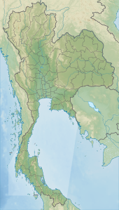
Back Taman Nasional Nam Phong BAN Nationalpark Nam Phong German Parque nacional de Nam Phong Spanish नाम फोंग राष्ट्रीय उद्यान Hindi നം ഫോങ് ദേശീയോദ്യാനം Malayalam อุทยานแห่งชาติน้ำพอง Thai
| Nam Phong National Park | |
|---|---|
| อุทยานแห่งชาติน้ำพอง | |
 Hin Chang Si | |
| Location | Thailand |
| Nearest city | Khon Kaen |
| Coordinates | 16°37′20″N 102°35′22″E / 16.62222°N 102.58944°E |
| Area | 197 km2 (76 sq mi) |
| Established | 2000 |
| Visitors | 68,273 (in 2019) |
| Governing body | Department of National Parks, Wildlife and Plant Conservation |
Nam Phong National Park (Thai: อุทยานแห่งชาติน้ำพอง) is a national park in Thailand's Khon Kaen and Chaiyaphum provinces. This mountainous park, in two separate sections, encompasses part of the Ubol Ratana Dam reservoir and also features rock formations and cliff-top viewpoints. The park is named for the Nam Phong River, impounded by the dam.[1][2]
© MMXXIII Rich X Search. We shall prevail. All rights reserved. Rich X Search
