Back Namdapha-Nationalpark German Parque nacional de Namdapha Spanish Namdaphan kansallispuisto Finnish Parc national de Namdapha French નમદાફા રાષ્ટ્રીય ઉદ્યાન Gujarati नमदाफा राष्ट्रीय उद्यान Hindi Parco nazionale di Namdapha Italian ನಂದಫಾ ರಾಷ್ಟ್ರೀಯ ಉದ್ಯಾನ Kannada നാംഡഭ ദേശീയോദ്യാനം Malayalam नामदाफा राष्ट्रीय उद्यान Marathi
| Namdapha National Park | |
|---|---|
 Canopy cover of Namdapha National Park | |
| Location | Changlang district, Arunachal Pradesh, India |
| Nearest city | Miao |
| Coordinates | 27°29′00″N 96°23′00″E / 27.48333°N 96.38333°E |
| Area | 1,985.23 km2 (766.50 sq mi) |
| Established | 1974 |
| Governing body | Government of Arunachal Pradesh, Government of India |
| arunachalforests | |
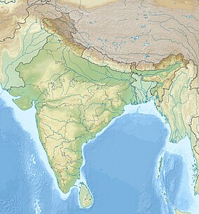
Namdapha National Park is a 1,985 km2 (766 sq mi) large protected area in Arunachal Pradesh of Northeast India. The park was established in 1983. With more than 1,000 floral and about 1,400 faunal species, it is a biodiversity hotspot in the Eastern Himalayas.[1] The national park harbours the northernmost lowland evergreen rainforests in the world at 27°N latitude.[2] It also harbours extensive dipterocarp forests, comprising the northwestern parts of the Mizoram-Manipur-Kachin rain forests ecoregion.[3]
It is the fourth largest national park in India.[4]
- ^ Deb, P. & Sundriyal, R. C. (2007). "Tree species gap phase performance in the buffer zone area of Namdapha National Park, Eastern Himalaya, India" (PDF). Tropical Ecology. 48 (2): 209–225.
{{cite journal}}: CS1 maint: multiple names: authors list (link) - ^ Proctor, J., Haridasan , K. & Smith, G.W. (1998). "How Far North does Lowland Evergreen Tropical Rain Forest Go?". Global Ecology and Biogeography Letters 7. 7 (2): 141–146. doi:10.2307/2997817. JSTOR 2997817.
{{cite journal}}: CS1 maint: multiple names: authors list (link) - ^ Cite error: The named reference
Dattawas invoked but never defined (see the help page). - ^ Ministry of Environment & Forests (2011). "List of national parks in India". ENVIS Centre on Wildlife & Protected Areas.
© MMXXIII Rich X Search. We shall prevail. All rights reserved. Rich X Search

