Back Nanumanga AST Nanumanqa Azerbaijani Нануманга Byelorussian Nanumaga Catalan Nanumaga Czech Nanumanga German Nanumanga Esperanto Nanumanga Spanish نانومانگا Persian Nanumanga Finnish
Nanumanga | |
|---|---|
Reef Island | |
 | |
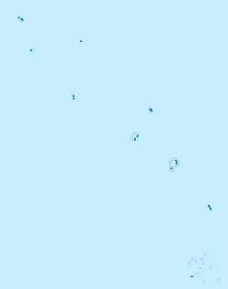
 Map of the island | |
| Coordinates: 06°17′15″S 176°19′15″E / 6.28750°S 176.32083°E | |
| Country | Tuvalu |
| Area | |
| • Total | 3 km2 (1 sq mi) |
| Population (2017) | |
| • Total | 491 |
| • Density | 160/km2 (420/sq mi) |
| Demonym | Nanumangan |
| ISO 3166 code | TV-NMG |
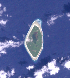
Nanumanga or Nanumaga is a reef island and a district of the Oceanian island nation of Tuvalu.[1][2] It has a surface area of about 3 km2 with a population of 491 (2017 census).[3]
- ^ "Maps of Tuvalu". Retrieved 15 January 2021.
- ^ British Admiralty Nautical Chart 766 Ellice Islands (1893 ed.). United Kingdom Hydrographic Office (UKHO). 21 March 1872.
- ^ "Population of communities in Tuvalu". Thomas Brinkhoff. 2017. Retrieved 27 September 2020.
© MMXXIII Rich X Search. We shall prevail. All rights reserved. Rich X Search
