| Ngel Nyaki Forest Reserve | |
|---|---|
| Majang Montane Forest Reserve (Nagombe, Joseph Titus (2018), "Ndola People and Region in African History", Legacy Perfect Digital Prints, Jalingo, Taraba State, Nigeria. | |
| Location | |
| Nearest city | Yelwa village |
| Coordinates | 7°05′N 11°04′E / 7.083°N 11.067°E |
| Area | 46 km2 |
| Established | 1969 |
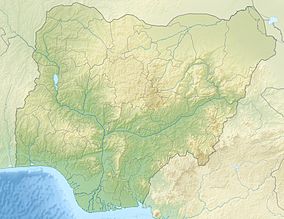
The Ngel Nyaki Forest Reserve, whose site is historically known as Majang, is situated on the Mambilla Plateau in North East Nigeria, covering 46 km2. It can be reached on foot from Yelwa village past the Mayo Jigawal, from where it is less than half an hour’s walk to the upper edge of the forest. The elevation ranges from 1,400 metres (4,593 ft) to 1,600 metres (5,249 ft).[1] Ngel Nyaki was formally gazetted a local authority Forest Reserve under Gashaka - Mambilla Native Authority Forest order of April 1969, but presently it is under the management of the Taraba State Government and the Nigerian Conservation Foundation (NCF), with the Nigerian Montane Forest Project (NMFP) as a project partner.
In November 2014 a long term monitoring vegetation plot was established in the reserve, funded by Nigerian philanthropist Theophilus Danjuma and, administered by the Nigerian Montane Forest Project. The research plot is part of the Center for Tropical Forest Science (CTFS) global network operated through the Smithsonian Tropical Research Institute.[2]
- ^ Birdlife International fact sheet
- ^ "Biodiversity Monitoring Plot - Afromontane Research - University of Canterbury - New Zealand". Archived from the original on 2015-01-13. Retrieved 2014-11-23.
© MMXXIII Rich X Search. We shall prevail. All rights reserved. Rich X Search

