North Central Colorado Urban Area | ||
|---|---|---|
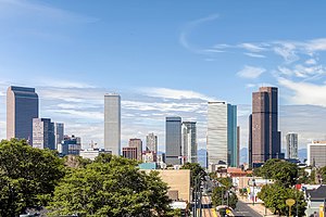
 Skyline of Downtown Denver | ||
 Interactive map of the North Central Colorado Urban Area
| ||
| Country | ||
| States | ||
| Largest city | - Denver | |
| Other principal cities |
| |
| Time zone | UTC−7 (MST) | |
| • Summer (DST) | UTC−6 (MDT) | |
The North Central Colorado Urban Area comprises the four contiguous metropolitan statistical areas in the north central region of the State of Colorado: the Denver–Aurora Metropolitan Statistical Area, the Boulder Metropolitan Statistical Area, the Fort Collins-Loveland Metropolitan Statistical Area, and the Greeley Metropolitan Statistical Area. With the exception of southeastern Elbert County, southeastern Park County, and tiny portions of southern Douglas County, the entire North Central Colorado Urban Area is drained by the South Platte River and its tributaries. The North Central Colorado Urban Area is the central, and the most populous, of the three primary subregions of the Front Range Urban Corridor.
The North Central Colorado Urban Area had a population of 3,390,504 at the 2010 United States Census, a 17.67% increase from the 2000 United States Census.[1] In 2010, 67.42% of Coloradans lived in the North Central Colorado Urban Area.
- ^ "U.S. Census website". United States Census Bureau. Retrieved May 11, 2011.
© MMXXIII Rich X Search. We shall prevail. All rights reserved. Rich X Search
