Back Northampton (lungsod sa Ostralya) CEB Northampton (Western Australia) German نورتهمپون، استرالیای غربی Persian Northampton (Australie) French Northampton (Australia) Italian Northampton (Australië) Dutch Northampton (Australia) Polish Northampton, Wastren Australie SCO Northampton (ort i Australien) Swedish
| Northampton Western Australia | |||||||||
|---|---|---|---|---|---|---|---|---|---|
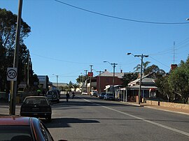
 Hampton Street | |||||||||
 | |||||||||
| Coordinates | 28°21′04″S 114°37′41″E / 28.35111°S 114.62806°E | ||||||||
| Population | 821 (UCL 2021)[1] | ||||||||
| Established | 1864 | ||||||||
| Postcode(s) | 6535 | ||||||||
| Area | 11.8 km2 (4.6 sq mi) | ||||||||
| Location | |||||||||
| LGA(s) | Shire of Northampton | ||||||||
| State electorate(s) | Moore | ||||||||
| Federal division(s) | Durack | ||||||||
| |||||||||
Northampton is a town 52 kilometres (32 mi) north of Geraldton, in the Mid West region of Western Australia. At the 2011 census, the town had a population of 868.[2] The town contains a National Trust building. The town lies on the North West Coastal Highway. Originally called The Mines, Northampton was gazetted in 1864 and named after the colony's Governor, John Hampton. The town was sited in the Nokanena Brook valley, between the hamlets around the two major copper mines in the area, the Wanerenooka and the Gwalla.[3]
It was the service town to the micronation, the Principality of Hutt River.
The town is known for its many wildflowers. Cave paintings at the Bowes River turnoff show that the region has been inhabited by Indigenous Australians.
The surrounding areas produce wheat and other cereal crops. The town has a receival site for Cooperative Bulk Handling.[4]
- ^ Australian Bureau of Statistics (28 June 2022). "Northampton (urban centre and locality)". Australian Census 2021.
- ^ Australian Bureau of Statistics. "Northampton (L)". 2011 census QuickStats. Retrieved 21 October 2013.
- ^ Wright, Judy (2006). Selling Sparrows. Dunstable, Bedfordshire: J.H. Wright & The Book Castle. p. 389. ISBN 978-0955351600.
- ^ "CBH receival sites" (PDF). 2011. Archived from the original (PDF) on 18 March 2012. Retrieved 1 April 2013.
© MMXXIII Rich X Search. We shall prevail. All rights reserved. Rich X Search
