Back Olten ALS أولتن Arabic أولتن ARZ Olten Catalan Olten (kapital sa distrito) CEB Olten Czech Ольтен CV Olten Danish Olten German Olten Esperanto
Olten | |
|---|---|
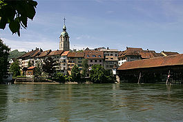
 Old town with covered bridge | |
| Coordinates: 47°21′N 7°54′E / 47.350°N 7.900°E | |
| Country | Switzerland |
| Canton | Solothurn |
| District | Olten |
| Government | |
| • Executive | Stadtrat with 5 members |
| • Mayor | Stadtpräsident (list) Thomas Marbet SPS/PSS (as of August 2021) |
| • Parliament | Gemeindeparlament with 50 members |
| Area | |
| • Total | 11.5 km2 (4.4 sq mi) |
| Elevation | 396 m (1,299 ft) |
| Population (31 December 2018)[2] | |
| • Total | 18,362 |
| • Density | 1,600/km2 (4,100/sq mi) |
| Time zone | UTC+01:00 (Central European Time) |
| • Summer (DST) | UTC+02:00 (Central European Summer Time) |
| Postal code(s) | 4600 |
| SFOS number | 2581 |
| ISO 3166 code | CH-SO |
| Surrounded by | Aarburg (AG), Boningen, Dulliken, Kappel, Rothrist (AG), Starrkirch-Wil, Trimbach, Wangen bei Olten, Winznau |
| Twin towns | Altenburg (Germany) |
| Website | olten SFSO statistics |
Olten (High Alemannic: Oute) is a town in the canton of Solothurn in Switzerland and capital of the district of the same name.
Olten grew into a town during the Middle Ages at the location of a bridge over the Aare. After a period of decline, it grew rapidly as a railway town in the 19th century. Its railway station is a major rail hub of Switzerland, located at the junction of lines to Zürich, Basel, Bern, and Lucerne, all of which are within 30 minutes by train, and the town is also home to a depot for Swiss Federal Railways.
- ^ a b "Arealstatistik Standard - Gemeinden nach 4 Hauptbereichen". Federal Statistical Office. Retrieved 13 January 2019.
- ^ "Ständige Wohnbevölkerung nach Staatsangehörigkeitskategorie Geschlecht und Gemeinde; Provisorische Jahresergebnisse; 2018". Federal Statistical Office. 9 April 2019. Retrieved 11 April 2019.
© MMXXIII Rich X Search. We shall prevail. All rights reserved. Rich X Search


