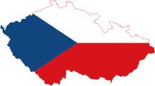


The following outline is provided as an overview of and topical guide to the Czech Republic:
The Czech Republic (also known as Czechia[1][2][3]) is a landlocked country in Central Europe. On 1 January 1993, Czechoslovakia peacefully dissolved into its constituent states, the Czech Republic and Slovakia. The Czech Republic is bordered by Poland to the north, Germany to the west, Austria to the south and Slovakia to the east. Its capital and largest city, with 1.3 million inhabitants, is Prague. It is a pluralist multi-party parliamentary representative democracy, a member of the European Union, NATO, the OECD, the OSCE, the Council of Europe, and the Visegrád Group.
- ^ "UNGEGN World Geographical Names". unstats.un.org. Retrieved 2017-10-06.
- ^ "Independent States in the World". U.S. Department of State. Retrieved 2017-10-06.
- ^ "The World Factbook — Central Intelligence Agency". www.cia.gov. Retrieved 2017-10-06.
© MMXXIII Rich X Search. We shall prevail. All rights reserved. Rich X Search


