Back مقاطعة أويهي (أيداهو) Arabic اوویهی بؤلگهسی، آیداهو AZB Owyhee County, Idaho BAR Оуайхи (окръг) Bulgarian ওৱাইহী কাউন্টি, আইডাহো BPY Owyhee Gông (Idaho) CDO Овайхи (гуо, Айдахо) CE Owyhee County CEB Owyhee County, Idaho Welsh Owyhee County German
Owyhee County | |
|---|---|
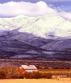
 Reynolds Creek Experimental Watershed in the Owyhee Mountains about 50 miles southwest of Boise. | |
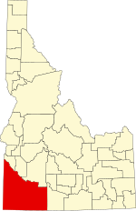
 Location within the U.S. state of Idaho | |
 Idaho's location within the U.S. | |
| Coordinates: 42°34′N 116°10′W / 42.56°N 116.17°W | |
| Country | |
| State | |
| Founded | December 31, 1863 |
| Named for | lost Hawaiian trappers |
| Seat | Murphy |
| Largest city | Homedale |
| Area | |
| • Total | 7,697 sq mi (19,940 km2) |
| • Land | 7,666 sq mi (19,850 km2) |
| • Water | 31 sq mi (80 km2) 0.4% |
| Population (2020) | |
| • Total | 11,913 |
| • Density | 1.6/sq mi (0.6/km2) |
| Time zone | UTC−7 (Mountain) |
| • Summer (DST) | UTC−6 (MDT) |
| Congressional district | 1st |
| Website | owyheecounty |
Owyhee County (/oʊˈwaɪ.hiː/ oh-WYE-hee) is a county in the southwestern corner of the U.S. state of Idaho. As of the 2020 census, the population was 11,913.[1] The county seat is Murphy,[2] and its largest city is Homedale.[3] In area it is the second-largest county in Idaho,[4] behind Idaho County.
Owyhee County is part of the Boise metropolitan area and contains slightly more than half of the Duck Valley Indian Reservation, which extends over the Nevada border, into Elko County. The majority of the federally recognized Shoshone-Paiute Tribe that is associated with this reservation lives on the Nevada side; its tribal center is in Owyhee, Nevada.
- ^ "Owyhee County, Idaho". United States Census Bureau. Retrieved June 25, 2023.
- ^ "Find a County". National Association of Counties. Retrieved June 7, 2011.
- ^ "Historic Homedale". Archived from the original on March 1, 2012. Retrieved December 13, 2009.
- ^ Colley, Evelyn Shaw (March 1, 1962). "Rich ore made Owyhee County boom". Lewiston Morning Tribune. (Idaho). p. 13.
© MMXXIII Rich X Search. We shall prevail. All rights reserved. Rich X Search
