| Paipa–Iza volcanic complex | |
|---|---|
 View of Iza volcano from the east | |
| Highest point | |
| Elevation | 2,500–2,770 m (8,200–9,090 ft) |
| Parent peak | Altiplano Cundiboyacense |
| Coordinates | 5°36′25.7″N 72°59′40.4″W / 5.607139°N 72.994556°W |
| Naming | |
| Native name | Complejo volcánico de Paipa–Iza (Spanish) |
| English translation | "cacique Paipa & place of healing" |
| Geography | |
| Location | Paipa & Iza, Boyacá |
| Parent range | Eastern Ranges, Andes |
| Geology | |
| Age of rock | Plio-Pleistocene |
| Mountain type | Volcanic field |
| Type of rock | Porphyritic plagioclase and sanidine-rich rhyolites |
| Volcanic belt | Andean Volcanic Belt Northern Volcanic Zone |
| Last eruption | Early Pleistocene |
| Climbing | |
| First ascent | Precolumbian |
| Easiest route | Drive to Paipa or Iza |
| Access | Partially restricted (quarries) Thermal baths touristic attraction |
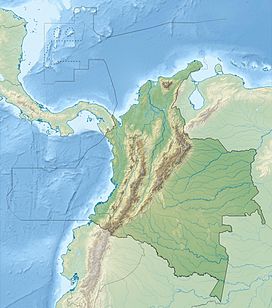
The Paipa–Iza volcanic complex is a volcanic field of Late Pliocene to Early Pleistocene age on the Altiplano Cundiboyacense in the Eastern Ranges of the Colombian Andes. It is the northernmost volcanic complex of the Andean Volcanic Belt with Fueguino in Tierra del Fuego, Chile, at the opposite end of the Andean mountain belt.
The complex, comprising mainly felsic extrusive volcanic rocks as rhyolites, also is the only confirmed volcanic province in the Eastern Ranges, with traces of probably contemporaneous explosive volcanic activity in the vicinity of Guatavita, Cundinamarca.
The Paipa-Iza volcanic field is important as a touristic site with thermal baths in both Paipa and Iza and is being studied for the potential of geothermal energy production and for the extraction of uranium in the area.
© MMXXIII Rich X Search. We shall prevail. All rights reserved. Rich X Search

