Back Pulo Paramushir ACE Paramoesjir Afrikaans جزيره باراموشير ARZ Paramuşir Azerbaijani Парамушыр Byelorussian Парамушир Bulgarian Paramuixir Catalan Ostrov Paramushir CEB Paramušir Czech Paramuschir German
This article needs additional citations for verification. (March 2012) |
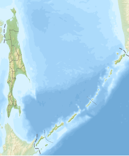
 Map of Paramushir Island | |
 | |
| Geography | |
| Location | Pacific Ocean |
| Coordinates | 50°20′N 155°45′E / 50.333°N 155.750°E |
| Archipelago | Kuril Island |
| Area | 2,053 km2 (793 sq mi) |
| Length | 100 km (60 mi) |
| Width | 20 km (12 mi) |
| Highest elevation | 1,816 m (5958 ft) |
| Highest point | Chikurachki |
| Administration | |
Russia | |
| Oblast | Sakhalin Oblast |
| District | Severo-Kurilsky |
| Largest settlement | Severo-Kurilsk (pop. 2592) |
 | |
Paramushir (Russian: Парамушир, romanized: Paramushir, Japanese: 幌筵島, romanized: Paramushiru-tō, Ainu: パラムシㇼ, romanized: Para=mu=sir) is a volcanic island in the northern portion of the Kuril Islands chain in the Sea of Okhotsk in the northwest Pacific Ocean. It is separated from Shumshu by the very narrow Second Kuril Strait in the northeast 2.5 km (1.6 mi), from Antsiferov by the Luzhin Strait (15 km (9.3 mi)) to the southwest, from Atlasov in the northwest by 20 km (12 mi), and from Onekotan in the south by the 40 km (25 mi) wide Fourth Kuril Strait. Its northern tip is 39 km (24 mi) from Cape Lopatka at the southern tip of the Kamchatka Peninsula. Its name is derived from the Ainu language, from “broad island” or “populous island”. Severo-Kurilsk, the administrative center of the Severo-Kurilsky district, is the only permanently populated settlement on Paramushir island.
© MMXXIII Rich X Search. We shall prevail. All rights reserved. Rich X Search
