Back Pavlovce nad Uhom Catalan Павловце-над-Угом CE Pavlovce nad Uhom Czech Pavlovce nad Uhom German Pavlovce nad Uhom Esperanto Pavlovce nad Uhom Spanish Pavlovce nad Uhom Basque Pavlovce nad Uhom French Pálóc Hungarian Pavlovce nad Uhom Italian
Pavlovce nad Uhom | |
|---|---|
Village | |
 | |
| Coordinates: 48°37′N 22°04′E / 48.617°N 22.067°E | |
| Country | Slovakia |
| Region | Košice |
| District | Michalovce |
| Area | |
| • Total | 32.19[2] km2 (12.43[2] sq mi) |
| Elevation | 106[3] m (348[3] ft) |
| Population (2021) | |
| • Total | 4,647[1] |
| Postal code | 072 14[3] |
| Area code | +421 56[3] |
| Car plate | MI |
| Website | www.pavlovce.sk |
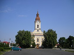
Pavlovce nad Uhom (Romani: Pavlovcis, Hungarian: Pálóc) is a village and municipality in the Slovak district of Michalovce, which lies in the Eastern Slovak Kosice Region.
Roughly 19 km (12 mi) southeast of the town of Michalovce, Pavlovce sits, as its name indicates, on the south bank of the Uzh River (Slovak: Uh), about 8 km (5.0 mi) west of the border with Ukraine. The population of the village is around 4,500 inhabitants. Apart from the village itself, which predates medieval times, the municipality Pavlovce nad Uhom was established in 1960 through the merger of two separate municipalities – Pavlovce nad Uhom and Ťahyňa.
- ^ "Počet obyvateľov podľa pohlavia - obce (ročne)". www.statistics.sk (in Slovak). Statistical Office of the Slovak Republic. 31 March 2022. Retrieved 31 March 2022.
- ^ a b "Hustota obyvateľstva - obce [om7014rr_ukaz: Rozloha (Štvorcový meter)]". www.statistics.sk (in Slovak). Statistical Office of the Slovak Republic. 31 March 2022. Retrieved 31 March 2022.
- ^ a b c d "Základná charakteristika". www.statistics.sk (in Slovak). Statistical Office of the Slovak Republic. 17 April 2015. Retrieved 31 March 2022.
- ^ a b "Hustota obyvateľstva - obce". www.statistics.sk (in Slovak). Statistical Office of the Slovak Republic. 31 March 2022. Retrieved 31 March 2022.
© MMXXIII Rich X Search. We shall prevail. All rights reserved. Rich X Search


