Back مقاطعة بنينغتون (داكوتا الجنوبية) Arabic Pennington County, South Dakota BAR Пенингтън (окръг, Южна Дакота) Bulgarian পেনিংটন কাউন্টি, সাউথ ডাকোটা BPY Pennington Gông (South Dakota) CDO Пеннингтон (гуо, Къилба Дакота) CE Pennington County (kondado sa Tinipong Bansa, South Dakota) CEB Pennington County, De Dakota Welsh Pennington County (South Dakota) German Κομητεία Πένινγκτον (Νότια Ντακότα) Greek
Pennington County | |
|---|---|
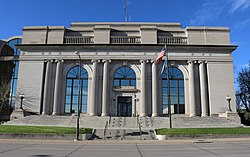
 Pennington County Courthouse in Rapid City | |
 Location within the U.S. state of South Dakota | |
 South Dakota's location within the U.S. | |
| Coordinates: 44°01′N 102°49′W / 44.01°N 102.82°W | |
| Country | |
| State | |
| Founded | 1875 (created) 1877 (organized) |
| Named for | John L. Pennington |
| Seat | Rapid City |
| Largest city | Rapid City |
| Area | |
| • Total | 2,784 sq mi (7,210 km2) |
| • Land | 2,777 sq mi (7,190 km2) |
| • Water | 7.8 sq mi (20 km2) 0.3% |
| Population (2020) | |
| • Total | 109,222 |
| • Estimate (2023) | 115,903 |
| • Density | 40/sq mi (20/km2) |
| Time zone | UTC−7 (Mountain) |
| • Summer (DST) | UTC−6 (MDT) |
| Congressional district | At-large |
| Website | www |
Pennington County is a county in the U.S. state of South Dakota. As of the 2020 census, the population was 109,222,[1] making it the second most populous county in South Dakota. Its county seat is Rapid City.[2] The county was created in 1875, and was organized in 1877.[3] It is named for John L. Pennington, fifth Governor of Dakota Territory, who held office in 1875 when the county was formed.[4]
Pennington County is included in the Rapid City metropolitan statistical area. It is also the location of Mount Rushmore.
- ^ "State & County QuickFacts". United States Census Bureau. Retrieved March 21, 2024.
- ^ "Find a County". National Association of Counties. Retrieved June 7, 2011.
- ^ "Dakota Territory, South Dakota, and North Dakota: Individual County Chronologies". Dakota Territory Atlas of Historical County Boundaries. The Newberry Library. 2006. Archived from the original on April 2, 2018. Retrieved March 31, 2015.
- ^ "Pennington County, SD History" Archived October 22, 2013, at the Wayback Machine. Pennington County official website. Retrieved January 8, 2011.
© MMXXIII Rich X Search. We shall prevail. All rights reserved. Rich X Search