Penshurst Airfield RAF Penshurst | |||||||||||
|---|---|---|---|---|---|---|---|---|---|---|---|
 The site of Penshurst Airfield, February 2010 | |||||||||||
| Summary | |||||||||||
| Airport type | Closed | ||||||||||
| Serves | Penshurst, Kent | ||||||||||
| Location | Leigh, Kent | ||||||||||
| Built | 1916 | ||||||||||
| In use | 1916–1936 1940–1946 | ||||||||||
| Occupants | 2 Wireless School RFC 268 Squadron RAF 653 Squadron RAF 661 Squadron RAF 664 Squadron RAF | ||||||||||
| Elevation AMSL | 177 ft / 54 m | ||||||||||
| Coordinates | 51°12′N 0°11′E / 51.200°N 0.183°E | ||||||||||
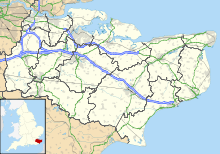
| Map | |||||||||||
| Runways | |||||||||||
| |||||||||||
Penshurst Airfield was an airfield in operation between 1916–36 and 1940–46. Initially a military airfield, after the First World War it was used as an alternate destination to Croydon Airport, with some civil flying taking place. The airfield closed following the crash of a Flying Flea at an air display in 1936, and was converted to a polo ground.
It re-opened during the Second World War as an Emergency Landing Ground, RAF Penshurst. As well as serving in this role, it was mainly used by air observation post (AOP) squadrons of the Royal Air Force. The airfield finally closed in May 1946.
© MMXXIII Rich X Search. We shall prevail. All rights reserved. Rich X Search

