Back مقاطعة بيري (ميزوري) Arabic Perry County, Missouri BAR Пери (окръг, Мисури) Bulgarian পেরী কাউন্টি, মিসৌরি BPY Perry Gông (Missouri) CDO Перри (гуо, Миссури) CE Perry County (kondado sa Tinipong Bansa, Missouri) CEB Perry County, Missouri Welsh Perry County (Missouri) German Κομητεία Πέρι (Μιζούρι) Greek
Perry County | |
|---|---|
 Perry County courthouse in Perryville | |
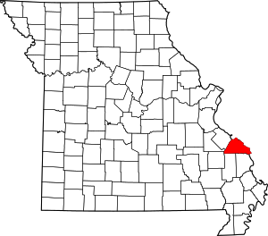
 Location within the U.S. state of Missouri | |
 Missouri's location within the U.S. | |
| Coordinates: 37°43′N 89°50′W / 37.71°N 89.83°W | |
| Country | |
| State | |
| Founded | November 16, 1820 |
| Named for | Oliver Hazard Perry |
| Seat | Perryville |
| Largest city | Perryville |
| Area | |
| • Total | 484 sq mi (1,250 km2) |
| • Land | 474 sq mi (1,230 km2) |
| • Water | 9.8 sq mi (25 km2) 2.0% |
| Population (2020) | |
| • Total | 18,956 |
| • Density | 39/sq mi (15/km2) |
| Time zone | UTC−6 (Central) |
| • Summer (DST) | UTC−5 (CDT) |
| Congressional district | 8th |
| Website | perrycountymo |
Perry County is a county located in the southeastern portion of the U.S. state of Missouri. As of the 2020 census, the population was 18,956.[1] Its county seat is Perryville.[2] The county was officially organized on November 16, 1820 (effective January 1, 1821) from Ste. Genevieve County and was named after Oliver Hazard Perry, a naval hero of the War of 1812.
- ^ "Explore Census Data".
- ^ "Find a County". National Association of Counties. Retrieved June 7, 2011.
© MMXXIII Rich X Search. We shall prevail. All rights reserved. Rich X Search