Back Parc national de Pigeon Island French पीजियण् आईलैंड राष्ट्रीय उद्यान Hindi ピジョン島国立公園 Japanese പിജിയൻ ഐലൻഡ് ദേശീയോദ്യാനം Malayalam Parcul național Pigeon Island Romanian පරවි දූපත ජාතික උද්යානය Singhalese புறாத்தீவு தேசிய பூங்கா Tamil 鴿子島國家公園 Chinese
| Pigeon Island National Park | |
|---|---|
 Pigeon Island | |
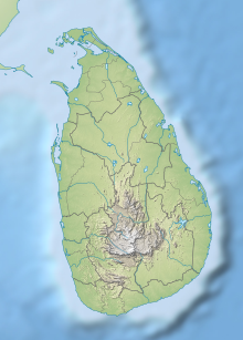
| Location | Eastern Province, Sri Lanka |
| Nearest city | Trincomalee |
| Coordinates | 8°43′N 81°12′E / 8.717°N 81.200°E |
| Area | 471.4 hectares (1.820 sq mi) |
| Established | 2003 |
| Governing body | Department of Wildlife Conservation |
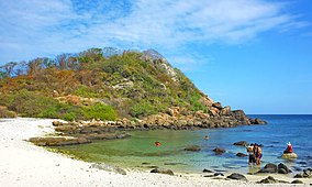
Pigeon Island National Park is one of the three marine national parks of Sri Lanka. The national park is situated 1 km off the coast of Nilaveli, a coastal town in Eastern Province, encompassing a total area of 471.429 hectares. The island's name derives from the rock pigeon which has colonized it. The national park contains some of the best remaining coral reefs of Sri Lanka.[1] Pigeon Island was designated as a sanctuary in 1963. In 2003 it was re-designated as a national park, making it the 17th such park in Sri Lanka. The island was used as a shooting range during the colonial era.[2] Pigeon Island was one of the several protected areas affected by the Indian Ocean tsunami in 2004.[3]
- ^ "Pigeon Island National Park". iwmi.org. International Water Management Institute. Archived from the original on 2011-10-07. Retrieved 2009-06-22.
- ^ Senarathna, P.M. (2009). Sri Lankawe Jathika Vanodhyana (in Sinhala) (2nd ed.). Sarasavi Publishers. pp. 220–221. ISBN 955-573-346-5.
- ^ Kariyawasam, Dayananda (3 March 2005). "Major plan under way to restore Lanka's natural ecosystems". Daily News. Archived from the original on 10 October 2012. Retrieved 2009-06-22.
© MMXXIII Rich X Search. We shall prevail. All rights reserved. Rich X Search
