Back بلايسيرفيل Arabic بلايسيرفيل ARZ پلیسرویل، آیداهو AZB Плейсървил Bulgarian Placerville (Idaho) Catalan Плейсервилл (Айдахо) CE Placerville, Idaho Welsh Placerville (Idaho) Spanish Placerville (Idaho) Basque پلیسرویل، آیداهو Persian
Placerville, Idaho | |
|---|---|
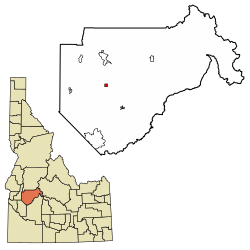
 Location of Placerville in Boise County, Idaho. | |
| Coordinates: 43°56′36″N 115°56′47″W / 43.94333°N 115.94639°W | |
| Country | United States |
| State | Idaho |
| County | Boise |
| Area | |
| • Total | 1.00 sq mi (2.59 km2) |
| • Land | 1.00 sq mi (2.59 km2) |
| • Water | 0.00 sq mi (0.00 km2) |
| Elevation | 4,324 ft (1,318 m) |
| Population | |
| • Total | 53 |
| • Estimate (2019)[3] | 57 |
| • Density | 57.00/sq mi (22.02/km2) |
| Time zone | UTC-7 (Mountain (MST)) |
| • Summer (DST) | UTC-6 (MDT) |
| ZIP code | 83666 |
| Area code(s) | 208, 986 |
| FIPS code | 16-63550 |
| GNIS feature ID | 0397043 |
| Website | placervilleidaho |
Placerville Historic District | |
| Location | Roughly bounded by the townsite limits |
|---|---|
| Coordinates | 43°56′35″N 115°56′49″W / 43.94306°N 115.94694°W |
| Area | 61 acres (25 ha) |
| Built | 1862 |
| Architect | Multiple |
| Architectural style | Colonial Revival, Queen Anne |
| NRHP reference No. | 84001029[4] |
| Added to NRHP | September 7, 1984 |
Placerville is a populated place in Boise County, Idaho, United States. The population was 53 at the 2010 census. It is part of the Boise City–Nampa, Idaho Metropolitan Statistical Area.
- ^ "2019 U.S. Gazetteer Files". United States Census Bureau. Retrieved July 9, 2020.
- ^ Cite error: The named reference
wwwcensusgovwas invoked but never defined (see the help page). - ^ Cite error: The named reference
USCensusEst2019CenPopScriptOnlyDirtyFixDoNotUsewas invoked but never defined (see the help page). - ^ "National Register Information System". National Register of Historic Places. National Park Service. March 13, 2009.
© MMXXIII Rich X Search. We shall prevail. All rights reserved. Rich X Search

