Back نیشاندەری شوێنی پلان CKB Plan Position Indicator Spanish Vue panoramique à angle d'élévation constant French Индикаторная электронно-лучевая трубка Russian Plan polär indikator Swedish


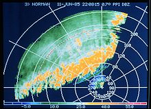
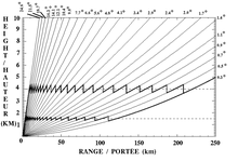
A plan position indicator (PPI) is a type of radar display that represents the radar antenna in the center of the display, with the distance from it and height above ground drawn as concentric circles. As the radar antenna rotates, a radial trace on the PPI sweeps in unison with it about the center point. It is the most common type of radar display.
© MMXXIII Rich X Search. We shall prevail. All rights reserved. Rich X Search