Back بوابة:لاوس Arabic Portail:Laos French Portal:Laos Portuguese Портал:Лаос Russian สถานีย่อย:ประเทศลาว Thai باب:لاؤس Urdu
Portal:Laos/Intro
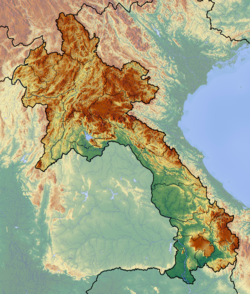
Laos (/ˈlɑːoʊs/ , /ˈlaʊs/, /ˈlɑːɒs/, or /ˈleɪɒs/; Lao: ລາວ, Lao pronunciation: [láːw], Lāo), or commonly referred to its colloquial name of Muang Lao (Lao: ເມືອງລາວ, Muang Lao), is a landlocked country in the heart of the Indochinese peninsula of Mainland Southeast Asia, bordered by Myanmar (Burma) and China to the northwest, Vietnam to the east, Cambodia to the southwest, and Thailand to the west and southwest. It traces its historic and cultural identity to the kingdom of Lan Xang Hom Khao (Kingdom of a Million Elephants Under the White Parasol), which existed for four centuries as one of the largest kingdoms in Southeast Asia. Due to Lan Xang's central geographical location in Southeast Asia, the kingdom was able to become a popular hub for overland trade, becoming wealthy economically as well as culturally. After a period of internal conflict, Lan Xang broke off into three separate kingdoms — Luang Phrabang, Vientiane, and Champasak. In 1893, it became a French protectorate, with the three territories uniting to form what is now known as the country of Laos. It briefly gained freedom in 1945 after Japanese occupation, but was recolonised by France until it won autonomy in 1949. Laos became independent in 1953 under King Sisavang Vong. The capital city is Vientiane. Other large cities include Luang Prabang, Savannakhet, and Pakse. The official language is Lao. Laos is a multi-ethnic country with the politically and culturally dominant Lao people making up approximately 60 percent of the population, mostly in the lowlands. Mon-Khmer groups, the Hmong, and other indigenous hill tribes, accounting for 40 percent of the population, live in the foothills and mountains. Laos' ambitious strategies for development are based on generating electricity from its rivers and selling the power to its neighbors, namely Thailand, China, and Vietnam, as well as its initiative to become a 'land-linked' nation, shown by the planning of four new railways connecting Laos to those same countries. This, along with growth of the mining sector, Laos has been referred to as one of East Asia and Pacific's fastest growing economies by the World Bank, with annual GDP growth averaging 7% for the past decade. It is a member of the Asia-Pacific Trade Agreement (APTA), Association of Southeast Asian Nations (ASEAN), East Asia Summit and La Francophonie. Laos became a member of the World Trade Organization (WTO) in 2013. Selected article -The Ho Chi Minh Trail (Vietnamese: Đường mòn Hồ Chí Minh), also called Annamite Range Trail (Vietnamese: Đường Trường Sơn) was a logistical network of roads and trails that ran from North Vietnam to South Vietnam through the kingdoms of Laos and Cambodia. The system provided support, in the form of manpower and materiel, to the Viet Cong (or "VC") and the People's Army of Vietnam (PAVN), during the Vietnam War. Construction for the network began following the North Vietnamese invasion of Laos in July 1959. At the time it was believed to be the main supply route, however it later transpired that the Sihanouk Trail which ran through Cambodia was handling significantly more materials
General images -The following are images from various Laos-related articles on Wikipedia.
Related portalsSoutheast Asia Other Countries Selected biography -
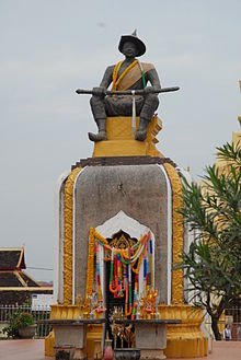
Setthathirath (Lao: ເສດຖາທິຣາດ; 24 January 1534 – 1571) or Xaysettha (Lao: ໄຊເສດຖາ; Thai: ไชยเชษฐาธิราช, RTGS: Chaiyachetthathirat, Burmese: ဇယဇေဋ္ဌာဓိရာဇ် Jayajyeṣṭhādhirāja) is considered one of the great leaders in Lao history. Throughout the 1560s until his death, he successfully defended his kingdom of Lan Xang against military campaigns of Burmese conqueror Bayinnaung, who had already subdued Xieng Mai (Chiang Mai) in 1558 and Ayutthaya in 1564. Setthathirath was a prolific builder and erected many Buddhist monuments including Wat Xieng Thong in Luang Prabang, Haw Phra Kaew, Wat Ong Teu Mahawihan and the Pha That Luang in Vientiane. (Full article...)
Selected picture View of the Wat Sen. WikiProjects
TopicsCategoriesDid you know?
Tasks
Associated WikimediaThe following Wikimedia Foundation sister projects provide more on this subject:
ContributorsDiscover Wikipedia using portals | |||||||||
© MMXXIII Rich X Search. We shall prevail. All rights reserved. Rich X Search


