| Main page | Maps |
The Maps and Cartography Portal

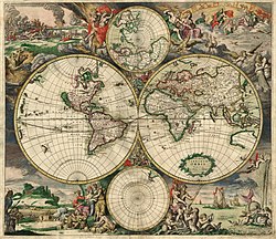
A map is a symbolic depiction of interrelationships, commonly spatial, between things within a space. A map may be annotated with text and graphics. Like any graphic, a map may be fixed to paper or other durable media, or may be displayed on a transitory medium such as a computer screen. Some maps change interactively. Although maps are commonly used to depict geographic elements, they may represent any space, real or fictional. The subject being mapped may be two-dimensional such as Earth's surface, three-dimensional such as Earth's interior, or from an abstract space of any dimension.
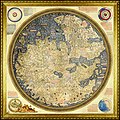
Maps of geographic territory have a very long tradition and have existed from ancient times. The word "map" comes from the medieval Latin: Mappa mundi, wherein mappa meant 'napkin' or 'cloth' and mundi 'of the world'. Thus, "map" became a shortened term referring to a flat representation of Earth's surface. (Full article...)
Cartography (/kɑːrˈtɒɡrəfi/; from Ancient Greek: χάρτης chartēs, 'papyrus, sheet of paper, map'; and γράφειν graphein, 'write') is the study and practice of making and using maps. Combining science, aesthetics and technique, cartography builds on the premise that reality (or an imagined reality) can be modeled in ways that communicate spatial information effectively. (Full article...)
Selected article -
Maps have been one of the most important human inventions, allowing humans to explain and navigate their way. When and how the earliest maps were made is unclear, but maps of local terrain are believed to have been independently invented by many cultures. The earliest putative maps include cave paintings and etchings on tusk and stone. Maps were produced extensively by ancient Babylon, Greece, Rome, China, and India.
The earliest maps ignored the curvature of Earth's surface, both because the shape of the Earth was uncertain and because the curvature is not important across the small areas being mapped. However, since the age of Classical Greece, maps of large regions, and especially of the world, have used projection from a model globe to control how the inevitable distortion gets apportioned on the map. (Full article...)
General images -
Selected quote
| “ | The Western World has been brainwashed by Aristotle for the last 2,500 years. The unconscious, not quite articulate, belief of most Occidentals is that there is one map which adequately represents reality. By sheer good luck, every Occidental thinks he or she has the map that fits. Guerrilla ontology, to me, involves shaking up that certainty. | ” |
| — Robert Anton Wilson, Robert Anton Wilson: Searching For Cosmic Intelligence - interview by Jeffrey Elliot | ||
Related portals
Related WikiProjects
Selected biography -

Georg Braun (also Brunus, Bruin; 1541 – 10 March 1622) was a German topo-geographer. From 1572 to 1617, he edited the Civitates orbis terrarum, which contains 546 prospects, bird's-eye views and maps of cities from all around the world. As principal editor of the work, he acquired the tables, hired the artists, and wrote the texts. He died as an octogenarian in 1622, the only survivor of the original team to witness the publication of volume VI in 1617. (Full article...)
Selected picture

Did you know
- ... that the Canadian League for Peace and Democracy organized a 10,000-person rally at Maple Leaf Gardens in Toronto to protest a 2,500-person fascist rally?
- ... that Maki Narukido researched the characters' travel times in her manga The End of the World With You using Google Maps?
- ... that the 100 gecs tree was listed as a "place of worship" on Google Maps?
- ... that Kathryn Maple won the Sunday Times Watercolour Competition twice in three years?
- ... that DeepStateMap.Live, an interactive map of the Russian invasion of Ukraine, received up to 120,000 visitors in 30 minutes during the Battle of Izium in the 2022 Kharkiv counteroffensive?
Topics
Map - Atlas - Geography - Topography
Cartography: Cartographers - History of cartography - Ancient world maps - World maps - Compass rose - Generalization - Geographic coordinate system - Geovisualization - Relief depiction - Scale - Terra incognita - Planetary cartography
Map projection: Azimuthal equidistant - "Butterfly" - Dymaxion - Gall–Peters - General Perspective - Goode homolosine - Mercator - Mollweide - Orthographic - Peirce quincuncial - Robinson - Sinusoidal - Stereographic
Maps: Animated mapping - Cartogram - Choropleth map - Estate map - Geologic map - Linguistic map - Nautical chart - Pictorial map - Reversed map - Road atlas - Thematic map - Topographic map - Weather map - Web mapping - World map
Map examples
World
Historical

Thematic
Geographic
Political

Nautical

Categories
Things you can do
|
Here are some Geography related tasks you can do:
|
Atlases and maps of the world at Wikimedia Commons
Associated Wikimedia
The following Wikimedia Foundation sister projects provide more on this subject:
-
Commons
Free media repository -
Wikibooks
Free textbooks and manuals -
Wikidata
Free knowledge base -
Wikinews
Free-content news -
Wikiquote
Collection of quotations -
Wikisource
Free-content library -
Wikiversity
Free learning tools -
Wiktionary
Dictionary and thesaurus
© MMXXIII Rich X Search. We shall prevail. All rights reserved. Rich X Search


