Although the construction of the square began in the 3rd century, the major structures within it were added in later periods. The outer complex consists of a number of 16th-century temples built during the reign of the Malla kings. These buildings are adorned with meticulously carved facades characteristic of Newar architecture. The central square is surrounded by palace complexes built during the Malla and Shah periods. The most well-known among them is the Nautalle Durbar, a nine-story palace built by Prithvi Narayan Shah to commemorate the Unification of Nepal. (Full article...)
This is a Good article, an article that meets a core set of high editorial standards.
Death of Rollo Gillespie (Cassell's illustrated history of India, 1890)
The Battle of Nalapani was the first battle of the Anglo-Nepalese War of 1814–1816, fought between the forces of the British East India Company and Nepal, then ruled by the House of Gorkha. The battle took place around the Nalapani fort, near Dehradun, which was placed under a month-long siege by the British, between 31 October and 30 November 1814. The fort's garrison was commanded by Captain Balbhadra Kunwar, while Major-General Robert Rollo Gillespie, who had previously fought in the Battle of Java, was in charge of the attacking British troops. Gillespie was killed on the first day of the siege while rallying his men. Despite considerable odds, both in terms of numbers and firepower, Balbhadra and his 600-strong garrison successfully held out against more than 5,000 British troops for over a month.
After two costly and unsuccessful attempts to seize the fort by direct attack, the British changed their approach and sought to force the garrison to surrender by cutting off the fort's external water supply. Having suffered three days of thirst, on the last day of the siege, Balbhadra, refusing to surrender, led the 70 surviving members of the garrison in a charge against the besieging force. Fighting their way out of the fort, the survivors escaped into the nearby hills. Considering the time, effort, and resources spent to capture the small fort, it was a pyrrhic victory for the British. A number of later engagements, including one at Jaithak, unfolded in a similar way; but more than any other battle of the war, the fighting around Nalapani established the Gurkhas' reputation as warriors. As a result, they were later recruited by the British to serve in their army. (Full article...)
Samay baji (Nepal Bhasa: समय् बजि) is an authentic traditional dish of Newar community in Nepal. In recent years this food has become one of the main attractions of Nepal. It is considered as a typical dish of the Newar community in Nepalese people. This dish has been passed down from many generations and is still much appreciated by the people. There are no specific seasons for this dish to be served but it is mostly served during auspicious occasions, in family get-togethers and Newari festivals. Samay baji is eaten as a starter in every festival, every religious activities and pujas. This is served in Sharada (death anniversary rituals) as well. It is eaten throughout the year because of its simplicity; it is easy to make and can be stored for a long time. The samay baji is also served during the major festivals of Nepal like Indra Jatra, Dashain, Tihar (Laxmi Puja, Bhai Tika). This dish is served in almost all the activities of Newari people. (Full article...)
Nepal has the deepest lake at the highest elevation. Shey Phoksundo is 145 meters deep and rests at 3600 meters.
Nepal has the densest concentration of World Heritage Sites. Kathmandu valley alone has 7 World Heritage Cultural sites within a radius of 15 kilometers.
The following pages at Wikimedia Commons contain a plethora of images taken in Nepal.
Wiki Loves Earth is an international photographic competition to promote natural heritage sites around the World through Wikimedia projects (mainly Wikipedia and Wikimedia Commons).
Wiki Loves Monuments is an international photographic competition to promote cultural monuments around the World through Wikimedia projects (mainly Wikipedia and Wikimedia Commons.
Image 2Senior offering Dashain Tika on great Nepali Hindu festival at a traditional home. (from Culture of Nepal)
Image 3A 1905 painting of Nepalese woman (from Culture of Nepal)
Image 4Nepali traditional Pahadi dress used for dance (from Culture of Nepal)
Image 5A map of the Himalayan region forcefully annexed by Gorkha Kings around 1768 as per the book published in 1819 by Francis Hamilton M. D. named "An Account of the Kingdom of Nepal and the Territories annexed to this Dominion by the House of Gorkha". (from History of Nepal)
This is a list of recognized content, updated weekly by JL-Bot (talk·contribs) (typically on Saturdays). There is no need to edit the list yourself. If an article is missing from the list, make sure it is tagged (e.g. {{WikiProject Nepal}}) or categorized correctly and wait for the next update. See WP:RECOG for configuration options.


.svg)


.png)


 "Nēpāla" in the late Brahmi script, in the Allahabad Pillar inscription of Samudragupta (350-375 CE). (from History of Nepal)
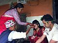 Senior offering Dashain Tika on great Nepali Hindu festival at a traditional home. (from Culture of Nepal)
 A 1905 painting of Nepalese woman (from Culture of Nepal)
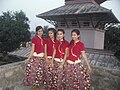 Nepali traditional Pahadi dress used for dance (from Culture of Nepal)
 A map of the Himalayan region forcefully annexed by Gorkha Kings around 1768 as per the book published in 1819 by Francis Hamilton M. D. named "An Account of the Kingdom of Nepal and the Territories annexed to this Dominion by the House of Gorkha". (from History of Nepal)
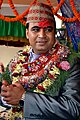 Nepali Pahadi groom (from Culture of Nepal)
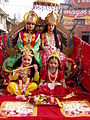 Costumed Hindu girls of Kathmandu during festival time in Nepal (from Culture of Nepal)
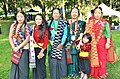 Women in cultural costume at Ubhauli Kirati festival 2017 at Gough Whitlam Park, Earlwood (from Culture of Nepal)
 Procession of Nepali Hindu Wedding (from Culture of Nepal)
 Statue of the Bodhisattva Avalokiteshvara, gilded bronze, Nepal, 16th century CE (from Culture of Nepal)
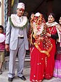 Nepali Pahadi Hindu marriage at Narayangadh, Chitawan (from Culture of Nepal)
 A Buddhist monastery in southern Nepal. (from Culture of Nepal)
 Procession of Nepali Pahadi Hindu Wedding (from Culture of Nepal)
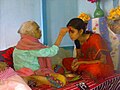 Senior offering Dashain Tika to junior (from Culture of Nepal)
 Mohar of king Prithvi Narayan Shah dated Saka Era 1685 (CE 1763) (from History of Nepal)
 Procession of Nepali Hindu Wedding; Groom being carried by a bride brother or relatives (from Culture of Nepal)


.jpg)


.jpg)


.jpg)


_(restoration).jpg)


_4.jpg)
_(restoration).jpg)


,_male,_Gokarna.jpg)


.jpg)
.jpg)
 Commons
 Wikibooks
 Wikidata
 Wikinews
 Wikiquote
 Wikisource
 Wikiversity
 Wikivoyage
 Wiktionary


