Back بريليب Arabic بريليب ARZ Prilep Azerbaijani Прылеп Byelorussian Прылеп BE-X-OLD Прилеп (град) Bulgarian Prilep BS Prilep (kapital sa munisipyo) CEB Prilep Czech Прилѣпъ CU
Prilep
Прилеп (Macedonian) | |
|---|---|
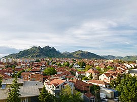
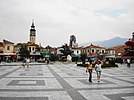
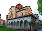
From top, clockwise: panorama of Prilep from Hotel Kristal Palas; Čento Square; Čarši Mosque ruins; Mound of the Unbeaten; Memorial Museum of October 11, 1941; Church of Saints Cyril and Methodius; commercial building in city centre | |
| Nickname: "The city under Marko's Towers" | |
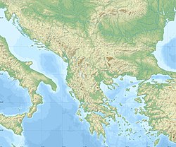
| Coordinates: 41°20′40″N 21°33′10″E / 41.34444°N 21.55278°E | |
| Country | |
| Region | |
| Municipality | |
| Government | |
| • Mayor | Borce Jovceski[1] |
| Area | |
| • Town | 1,194.44 km2 (461.18 sq mi) |
| • Urban | 19.29 km2 (7.45 sq mi) |
| Elevation | 620 m (2,030 ft) |
| Population (2021) | |
| • Town | 63,308 |
| • Density | 64.27/km2 (166.5/sq mi) |
| • Urban | 63,308 |
| • Urban density | 3,300/km2 (8,500/sq mi) |
| • Metro | 79,834 |
| Time zone | UTC+1 (CET) |
| Postal codes | 7500 |
| Area code | (+389) 048 |
| Patron saints | Saint Nicholas |
| Climate | Cfa |
| Website | www |
Prilep (Macedonian: Прилеп [ˈpriːlɛp] ) is the fourth-largest city in North Macedonia.[2] According to 2021 census, it had a population of 63,308.
- ^ "Mayor | Prilep". Municipality of Prilep. Archived from of Prilep the original on 5 March 2016. Retrieved 15 September 2015.
{{cite web}}: Check|url=value (help) - ^ "Prilep Map - Western Macedonia". Mapcarta.com. 2017. Retrieved 1 December 2017.
© MMXXIII Rich X Search. We shall prevail. All rights reserved. Rich X Search


