Back Pula Afrikaans بولا (مدينة) Arabic پولا ARZ Pula Azerbaijani Пула Bashkir Пула Byelorussian Пула (Харватыя) BE-X-OLD Пула Bulgarian Pula BS Pula Catalan
Pula
Pola | |
|---|---|
| Grad Pula / Città di Pola City of Pula | |
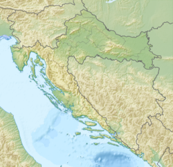
 Location of Pula in Croatia | |
| Coordinates: 44°52′13″N 13°50′44″E / 44.87028°N 13.84556°E | |
| Country | |
| County | |
| Government | |
| • Mayor | Filip Zoričić (Ind.) |
| • City Council | 22 members[1] |
| Area | |
• City | 53.8 km2 (20.8 sq mi) |
| • Land | 41.59 km2 (16.06 sq mi) |
| • Urban | 53.8 km2 (20.8 sq mi) |
| Elevation | 30 m (100 ft) |
| Population (2021)[3] | |
• City | 52,220 |
| • Density | 970/km2 (2,500/sq mi) |
| • Urban | 52,220 |
| • Urban density | 970/km2 (2,500/sq mi) |
| Time zone | UTC+1 (CET) |
| • Summer (DST) | UTC+2 (CEST) |
| Postal code | HR-52 100 |
| Area code | +385 52 |
| Vehicle registration | PU |
| Website | pula |
Pula,[a] also known as Pola,[4][b] is the largest city in Istria County, Croatia, and the seventh-largest city in the country, situated at the southern tip of the Istrian peninsula in western Croatia, with a population of 52,220 in 2021.[3] It is known for its multitude of ancient Roman buildings, the most famous of which is the Pula Arena, one of the best preserved Roman amphitheaters. The city has a long tradition of wine making, fishing, shipbuilding, and tourism. It was the administrative centre of Istria from ancient Roman times until superseded by Pazin in 1991.
- ^ "Vijećnici Gradskog vijeća". pula.hr. City of Pula. Retrieved 28 April 2024.
- ^ Register of spatial units of the State Geodetic Administration of the Republic of Croatia. Wikidata Q119585703.
- ^ a b "Population by Age and Sex, by Settlements" (xlsx). Census of Population, Households and Dwellings in 2021. Zagreb: Croatian Bureau of Statistics. 2022.
- ^ Lalli Paćelat, Ivana; Brkić Bakarić, Marija; Matticchio, Isabella (30 October 2020). "Službena dvojezičnost u Istarskoj županiji: stanje i perspektive" [Official Bilingual Status in Istria County: State and Perspectives]. Rasprave Instituta za hrvatski jezik (in Croatian). pp. 815–837. doi:10.31724/rihjj.46.2.20. eISSN 1849-0379.
Cite error: There are <ref group=lower-alpha> tags or {{efn}} templates on this page, but the references will not show without a {{reflist|group=lower-alpha}} template or {{notelist}} template (see the help page).
© MMXXIII Rich X Search. We shall prevail. All rights reserved. Rich X Search


