 RAF Catfoss on a target dosier of the german air force, 1941 | |||||||||||||||||||
| Summary | |||||||||||||||||||
| Airport type | Royal Air Force station | ||||||||||||||||||
| Owner | Ministry of Defence | ||||||||||||||||||
| Operator | Royal Air Force | ||||||||||||||||||
| Location | Brandesburton, East Riding of Yorkshire, England | ||||||||||||||||||
| Built | 1930 | ||||||||||||||||||
| In use | 1932 – 1945 1958 – 1963 | ||||||||||||||||||
| Elevation AMSL | 36 ft / 11 m | ||||||||||||||||||
| Coordinates | 53°55′15″N 000°16′30″W / 53.92083°N 0.27500°W | ||||||||||||||||||
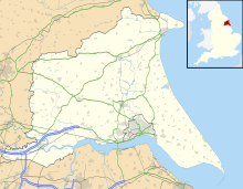
| Map | |||||||||||||||||||
| Runways | |||||||||||||||||||
| |||||||||||||||||||
Royal Air Force Catfoss, or more simply RAF Catfoss, is a former Royal Air Force station during the Second World War. It was located 4 miles (6.4 km) west of Hornsea, East Riding of Yorkshire, England and 8 miles (13 km) north-east of Leconfield, East Riding of Yorkshire, with the nearest village being Brandesburton.
The airfield was opened in 1932 for an Armament Training Camp. A small number of fighters were posted there, at the start of the Second World War, before the airfield was rebuilt as a bomber station. It initially closed in November 1945, but re-opened in 1959 as a site for the PGM-17 Thor ballistic missile. It closed again in 1963.
© MMXXIII Rich X Search. We shall prevail. All rights reserved. Rich X Search


