Rampura Thana
রামপুরা থানা | |
|---|---|
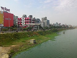
 Rampura in 2019 | |
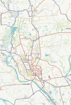
 Expandable map of vicinity of Rampura Thana | |
| Coordinates: 23°45′40″N 90°25′15″E / 23.76124°N 90.4207°E | |
| Country | |
| Division | Dhaka Division |
| District | Dhaka District |
| Established as a thana | 2009 |
| Area | |
| • Total | 2.8 km2 (1.1 sq mi) |
| Elevation | 23 m (75 ft) |
| Population (2011)[2] | |
| • Total | 224,079 |
| • Density | 80,028/km2 (207,270/sq mi) |
| Time zone | UTC+6 (BST) |
Rampura Thana (Bengali: রামপুরা থানা) is a police administrative area (thana) of Dhaka, Bangladesh. It encloses parts of Banasree residential area and Dhaka North City Corporation wards 22 and 23. The major thoroughfare DIT Road passes through this area and connects it to Badda, Ramna & Motijheel thanas.
- ^ "Geographic coordinates of Dhaka, Bangladesh". DATEANDTIME.INFO. Retrieved 7 July 2016.
- ^ Bangladesh Bureau of Statistics (2011). "Population & Housing Census" (PDF). Bangladesh Government. Archived from the original (PDF) on 3 September 2017. Retrieved 17 April 2015.
© MMXXIII Rich X Search. We shall prevail. All rights reserved. Rich X Search


