Back مقاطعة راندال (تكساس) Arabic Randall County, Texas BAR Рэндал (акруга) Byelorussian Рандал (окръг, Тексас) Bulgarian রেনডাল কাউন্টি, টেক্সাস BPY Randall Gông (Texas) CDO Randall County CEB Randall County Czech Randall County, Texas Welsh Randall County German
Randall County | |
|---|---|
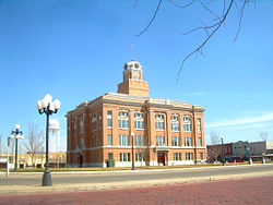
 The Randall County Courthouse in 2011 | |
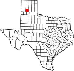
 Location within the U.S. state of Texas | |
 Texas's location within the U.S. | |
| Coordinates: 34°58′N 101°54′W / 34.97°N 101.9°W | |
| Country | |
| State | |
| Founded | 1889 |
| Named for | Horace Randal |
| Seat | Canyon |
| Largest city | Amarillo |
| Area | |
| • Total | 922 sq mi (2,390 km2) |
| • Land | 912 sq mi (2,360 km2) |
| • Water | 11 sq mi (30 km2) 1.2% |
| Population (2020) | |
| • Total | 140,753 |
| • Density | 150/sq mi (59/km2) |
| Time zone | UTC−6 (Central) |
| • Summer (DST) | UTC−5 (CDT) |
| Congressional district | 13th |
| Website | www |
Randall County is a county located in the U.S. state of Texas. As of the 2020 census, its population was 140,753.[1] Its county seat is Canyon.[2] The county was created in 1876 and later organized in 1889.[3] It is named for Horace Randal, a Confederate brigadier general killed at the Battle of Jenkins Ferry. The reason the county name differs from his is because the bill creating the county misspelled Randal's name.
Randall County, alongside adjacent Potter County is part of the Amarillo Metropolitan Statistical Area.
At one time, the large JA Ranch, founded by Charles Goodnight and John George Adair, which reached into six counties, held acreage in Randall County.
- ^ "Randall County, Texas". United States Census Bureau. Retrieved January 30, 2022.
- ^ "Find a County". National Association of Counties. Retrieved June 7, 2011.
- ^ "Texas: Individual County Chronologies". Texas Atlas of Historical County Boundaries. The Newberry Library. 2008. Retrieved May 26, 2015.
© MMXXIII Rich X Search. We shall prevail. All rights reserved. Rich X Search
