Back রানীক্ষেত Bengali/Bangla রানিখেত BPY Ranikhet Catalan Rānīkhet CEB Ranikhet Spanish રાણીખેત Gujarati रानीखेत Hindi Ranikhet Italian Ranikhet Malagasy റാണിഖേത് Malayalam
Ranikhet | |
|---|---|
Town | |
|
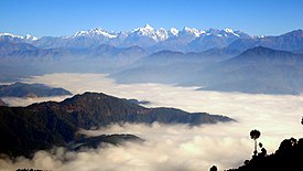
Left to right; top to bottom: passing-out parade at KRC, golf course, Himalayan view, Bhalu Dam Lake at Chaubatia, Haidakhan temple at Chiliyanaula and Ranikhet skyline | |
| Nickname: Ranikhet | |
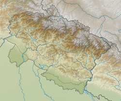
| Coordinates: 29°39′N 79°25′E / 29.65°N 79.42°E | |
| Country | |
| State | Uttarakhand |
| District | Almora |
| Elevation | 1,869 m (6,132 ft) |
| Population (2011) | |
| • Total | 19,049 |
| Languages | |
| • Official | Hindi, Kumaoni, Sanskrit |
| • Native | Kumaoni |
| Time zone | UTC+5:30 (IST) |
| Vehicle registration | UK-20 |
| Website | uk |
Ranikhet (Kumaoni: Rānikhèt) is a hill station and cantonment town, near Almora Town in Almora district[1] in the Indian state of Uttarakhand. It is the home of the Military Hospital, Kumaon Regiment[2] (KRC) and Naga Regiment[2] and is maintained by the Indian Army.
Ranikhet is at an altitude of 1,869 metres (6,132 ft) above sea level, within sight of the western peaks of the Himalayas. Ranikhet is a Class IV town with a civic status of a Cantonment board.[3]
- ^ "Ranikhet | Uttarakhand Tourism Development Board | Department of Tourism, Government Of Uttarakhand, India". | Uttarakhand Tourism Development Board | Department of Tourism, Government Of Uttarakhand, India. Retrieved 12 May 2020.
- ^ a b "The Official Home Page of the Indian Army". www.indianarmy.nic.in. Retrieved 31 December 2020.
- ^ "RANIKHET CANTONMENT BOARD". Census of India, 2011. Retrieved 10 April 2020.
© MMXXIII Rich X Search. We shall prevail. All rights reserved. Rich X Search


